The latest weather forecast showed that isolated tornadoes could affect the coasts of Georgia, North Carolina, and South Carolina due to stormy outlook in the region.
Georgia and parts of Carolina are no strangers to extreme weather events, including tornadoes. The windy conditions could likely unleash isolated tornadoes.
In addition, they could expect rainy outlook and chances of thunderstorms.
Residents should monitor the weather conditions this week.
Weather outlook in Georgia and parts of Carolinas
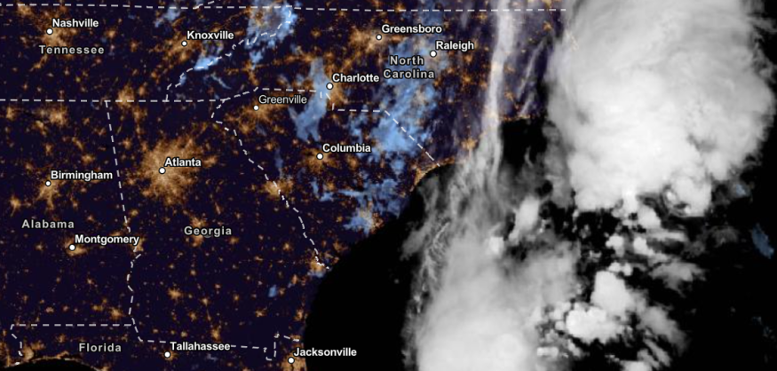
According to the National Weather Service (NWS), the agency monitored frontal systems and low-pressure areas' developments over the Mid-Atlantic.
The front systems can help bring rainy conditions to the US East Coast.
Meanwhile, the NWS reported the possible damaging winds and isolated tornadoes on the coasts of North Carolina, South Carolina, and Georgia next week due to developing storms.
Residents should stay updated with tornado watches and warnings in the affected areas.
Residents in the areas can expect rainy conditions in Georgia and parts of Carolinas starting Monday.
In the Northwest Texas and Oklahoma, severe thunderstorms are likely in the region on Tuesday. The severe outlook could bring heavy rain, damaging winds and large hail.
Weather outlook in Florida Peninsula, New Orleans
In nearby New Orleans, the advisory noted the above-normal temperatures this week. There is a low chance of rain in the early next week in the region.
Rain returns to the forecast as a frontal boundary stalling over the Florida Peninsula will maintain a fairly wet pattern today into next week. Don't forget your umbrellas☔⛈️
— NWS Tampa Bay (@NWSTampaBay) September 15, 2023
Today, highs will be mainly in the lower 90s, but some inland locations may reach the mid 90s.🌡️#FLwx pic.twitter.com/UHae8lYBeZ
In Tampa Bay, scattered showers and thunderstorms could be likely in the region. The wet weather pattern is expected until this week, especially in Southwestern and Lake Okeechobee.
In the Florida Peninsula, the forecast noted the wet weather conditions over the central and southern parts. The developing slow-moving cold front could help with the thunderstorms and widespread rain this week.
In Illinois and Indiana, the forecast noted stormy conditions with chances of thunderstorms due to weak systems in the region. However, the end of the week could unleash continued dry conditions.
Also Read : US Weather Forecast: Heavy Rain to Hit New England, Arizona, Central Wyoming, Colorado Early Week
Weather in the US East Coast, Southern and Central Rockies
The NWS advisory added that showers and thunderstorms could be likely in the Central and Southern Plains on Tuesday due to atmospheric moisture.
On Tuesday, severe storms could hit the Southern Plains. The unsettled weather outlook could be the problem, bringing possible slower commutes or flooded roads.
In the US East Coast, showers are likely on Monday in the region. Residents could expect average temperatures.
The heavy rain outlook in the affected areas can bring potential flooding and landslides. Americans should stay alert for possible flood watches.
Meanwhile, the chance of isolated tornadoes and damaging winds can lead to possible damage to trees and powerlines. Residents should stay alert for tornado alerts, especially at night.
For more similar stories, don't forget to follow Nature World News.
© 2026 NatureWorldNews.com All rights reserved. Do not reproduce without permission.


