The National Weather Service (NWS) announced that stormy conditions and potentially elevated fire concerns are likely in parts of the Texas-Oklahoma Panhandle.
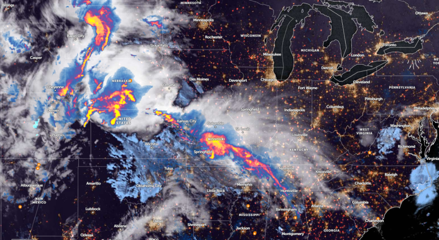
NWS Weather Prediction Center reports an active stretch of heavy rainfall in the Central and Southern U.S. this week, causing potentially multiple storm systems through the weekend. Significant heavy rainfall can occur on Saturday, with a moderate risk of excessive rainfall.
Additionally, the advisory reports an increasing risk of flash flooding in central and eastern Oklahoma on Saturday night.
Meanwhile, portions of the central U.S. can expect unsettled weather and severe thunderstorms this week. Next month, commuters can anticipate an active weather outlook in the region, causing heavy rains and flooded roadways.
Homeowners should limit outdoor activities this week due to stormy potential. Staying updated with the latest forecasts can help people stay safe from challenging weather.
Weather Conditions in Oklahoma and Texas Panhandle
According to a National Weather Service (NWS) advisory, a stormy weather outlook could impact portions of the Southern High Plains, including in Texas - Oklahoma Panhandle and West to Southwest Texas. The forecast shows that windy and dry conditions are also expected.
Due to the windy outlook and low relative humidity, homeowners should keep alert for elevated to critical fire weather conditions this weekend.
Meanwhile, the NWS Storm Prediction Center warned of severe thunderstorm chances and critical fire weather this weekend. Challenging weather outlook can unload in western Kansas and Southwest Oklahoma.
From April 25 to April 27, severe thunderstorms are likely in the lower Missouri Valley and parts of the Midwest. The main risks are tornadoes, large hail, and hazardous commutes.
Additionally, a thunderstorm activity could unload in Lower Arkansas and Central Plains this late week. Homeowners should stay alert for heavy rain potential, impacting low-lying areas in the region.
In Kansas, the latest advisory reveals that multiple rounds of strong to severe thunderstorms can unload this weekend, bringing flash flooding. The rounds of heavy rain can likely trigger potential flooding.
For Houston residents, a slow-moving boundary is likely in SE Texas this late week, causing potential scattered showers. On Friday, severe storm conditions can unfold, including in portions of Brazos Valley to Piney Woods region.
Read also: Oklahoma, Tennessee Valley Forecast: Stormy Conditions Likely to Affect Daily Commutes This Week
Weather Preparedness in Texas-Panhandle and Central U.S.
The latest weather report warns of a poor weather outlook in the Texas-Panhandle and Central US until the weekend. The primary threats are heavy rain, flooding, hail, and strong tornadoes.
Commuters should check for road conditions before traveling, preventing road dangers. When the storms become challenging, it is best that Americans should limit any outdoor plans.
Additionally, homeowners should store emergency kits this week, as severe thunderstorms can continue until the weekend.
Meanwhile, elevated fire concerns can occur due to low relative humidity and strong winds. To prevent fire, it is advisable to avoid outdoor burning.
For more similar stories, don't forget to follow Nature World News
© 2026 NatureWorldNews.com All rights reserved. Do not reproduce without permission.


