Experts warned that new eruptions could emerge in Iceland's volcano due to the continuous magma movement.
The Iceland MET Office said that new fissures could emerge on the surface of Grindavík in the coming days. Authorities said that the hazard assessment map has already been updated.
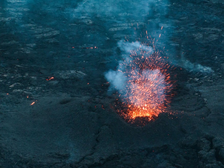
Decreasing Lava Flow
Based on the webcam footage, experts noted that it is evident that the lava flow has decreased from the eruptive fissures, which opened yesterday.
They observed that the flow from the southern eruptive fissure, which emerged around noon yesterday near the town's border, seems to have ceased.
Officials said that the majority of the remaining lava flow is now directed southwest along the protective barriers, and its trajectory seems to have stabilized.
Still, the Iceland MET Office assessed that it is still difficult to estimate how long the volcanic eruption will last.
Seismic activity has decreased, and GPS measurements had indicated that the rate of deformation in the area has reduced. However, deformation is still detected near the southernmost part of the magma conduit beneath Grindavík.
Furthermore, measurements indicated that there has been a displacement of up to 1.4 meters in the past 24 hours, which is distributed across numerous fissures within the town's boundaries.
On the other hand, fresh fissures have developed, and existing ones have expanded.
Additional Fissures May Emerge
It is possible that additional fissures may emerge on the surface in the next few days, according to the Iceland MET Office.
As previously stated by authorities, the eruption sites are extremely hazardous, and the possibility of new fissures emerging without warning cannot be dismissed.
This assessment was backed and demonstrated by the eruptive fissure that appeared near the border of Grindavík yesterday, which provided no recognizable warning signs on the monitoring equipment.
So far, there is a mild wind from the northeast at the eruption sites, but it is seen to pick up speed later in the day.
Due to this development, gas pollution is drifting southwest towards the ocean.
Meanwhile, on Wednesday, the area will experience winds from the north reaching 10-18 m/s, causing the gas to drift south.
The Iceland MET Office continues to monitor the area and is in direct contact with civil protection and response teams in the region about the progression of the event. This is to ensure the safety of residents in the area.
The Iceland MET Office's weather forecast for gas distribution from the eruption at Hagafell indicated that the direction is north and northeast, with a speed of 3-8 m/s, with the weather is dry and bright at present.
Experts said that it would be cloudy at times with minor snowfall late tonight and tomorrow morning. It will clear up in the afternoon tomorrow. Pollution from the eruption is spreading south and southwest.
To recall, an intense series of earthquakes began at the Sundhnúksgígar crater row on January 14.
During that time, more than 200 earthquakes have been measured in the area, and the seismicity has moved towards the town of Grindavík.
So far, the largest recorded earthquake is 3.5 in magnitude, and it was measured at 04:07 UTC at Hagafell.
Both real-time GPS measurements and borehole pressure readings have shown major changes since the onset of today's earthquake activity.
These observations, in addition to the ongoing seismicity, confirm that magma has been moving within the region.
Related Article : Iceland Volcano on the Verge of Erupting With Massive Lava Fountains, Geologists Warn
© 2026 NatureWorldNews.com All rights reserved. Do not reproduce without permission.


