Experts alerted people to the possibility of an enormous volcanic explosion near Blue Lagoon, prompting Iceland to declare a State of Emergency and order an evacuation.
State of Emergency
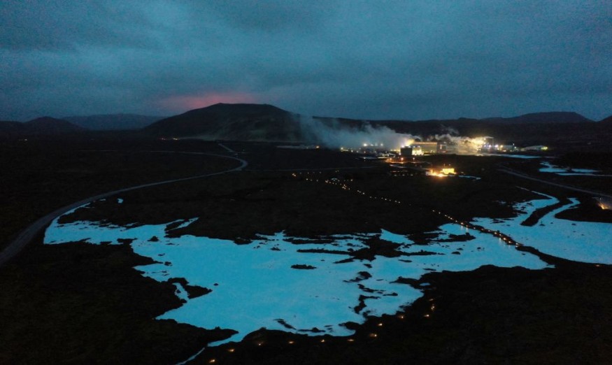
Iceland has declared a state of emergency and evacuated a town 25 miles southwest of its capital Reykjavik due to the imminent threat of a volcanic eruption.
The decision comes as weeks of tremors suggested an underground magma intrusion near Grindavik on the Reykjanes peninsula.
Grindavik, home to around 3,600 people and located near the famed Blue Lagoon, is near the Svartsengi power plant.
The Icelandic Met Office says that the likelihood of a magma intrusion extending beneath Grindavík, with heightened seismic activity.
Authorities are fortifying the area's infrastructure, temporarily closing the Blue Lagoon as a precaution. There have been three eruptions in the region since 2021 after 800 years of dormancy.
If a rift extends into the sea, an explosive eruption could impact air traffic at Reykjavik's Keflavik Airport, although the overall impact may be less severe than the 2010 Eyjafjallajokull eruption that disrupted European air travel for weeks.
Iceland Impending Volcanic Eruptions
Iceland, with over 30 volcanic systems and 600 hot springs, is highly geologically active due to its location on the mid-Atlantic ridge.
Positioned where the North American and Eurasian tectonic plates meet, the country faces frequent eruptions.
The last significant threat occurred in 1973, burying part of a town in the Westman Islands. The current situation on the Reykjanes peninsula remains uncertain, but experts like Thordarson emphasized that an eruption is a matter of when, not if.
Earthquake Updates for Grindavík on the Reykjanes Peninsula
On November 10, a dike intrusion near Grindavík, Reykjanes Peninsula, triggered the Civil Protection's emergency phase, leading to Grindavik's evacuation.
In 24 hours, 3000 earthquakes, mainly along the inferred magma path, were detected. Stress-induced earthquakes were observed offshore, south of Reykjanes.
The Icelandic Meteorological Office closely monitors.
Since midnight, 800 earthquakes have occurred in the magma region, with reduced but still high activity. Recent earthquakes centered near Grindavík suggest the magmatic dike's southwest end location.
A joint analysis of ground and satellite data reveals the intrusion's unprecedented size and movement rate on the Reykjanes Peninsula.
Latest Updates of Fagradalsfjall Volcano
In recent weeks, thousands of tremors were recorded around Iceland's Fagradalsfjall volcano, concentrated in the Reykjanes Peninsula.
However, volcanic activity was last reportted on August 5, at 17:06, when the Icelandic Meteorological Office lowered the Aviation Color Code for Fagradalsfjall to Yellow. This second-level status reflected a decline in eruption and minimal crater activity visible in webcam images.
Tremor levels dropped to background levels by 15:00 on August 5, with gas plumes typically reaching 1-2 km, though exceeding 2.5 km on August 1.
The crater became deeper and smaller by August 4, with the last observed activity on August 5 and a thermal anomaly identified on August 6.
Latest Updates of Eyjafjallajokull Volcano
On the other hand, Eyjafjallajökull's sustained activity ceased on May 22, 2010. By June 23, 2010, the Iceland Meteorological Office and the University of Iceland Institute of Earth Sciences (IES) stopped regular status reports.
This report covers the eruption's final stages and references selected abstracts and papers from conferences and publications on the event.
The initial eruption phase occurred at Fimmvörðuháls from March 20 to April 12, 2010, followed by ash emissions from Eyjafjallajökull's summit crater on April 14, disrupting air travel over Europe for nearly a week.
© 2026 NatureWorldNews.com All rights reserved. Do not reproduce without permission.


