Typhoon Nanmadol made landfall in southern Japan on Sunday, September 18, bringing heavy rainfall and the risk of deadly landslides.
The storm's arrival forced local authorities to issue evacuation orders for over eight million people and seek shelter from the powerful weather event, dubbed as the strongest storm of 2022.
Forecasters predicted that Nanmadol will move in a northward pattern to cover the entire country.
The raging storm struck the East Asian country's southernmost island of Kyushu.
As a result, Japanese weather authorities issued a "special alert" for the island due to additional threats like storm surges affecting the coastline and strong winds that can destroy houses.
Widespread travel disruption has been reportedly already, including railway, airport, and maritime services.
Also known as Typhoon No. 14 in Japan, the slow-moving super typhoon placed most of Japan under alert for severe weather conditions.
Authorities are also expecting the typhoon will bring high winds or tornadoes.
Heavy rain could result not only in mudslides but also flooding; which can be reportedly triggered by potential several inches of downpour until Monday, September 19.
Japan's typhoon or storm season spans from May to October each year; wherein the frequency and intensity of storm peak during August and September.
Majority of these storms form over the northwestern Pacific Ocean.
Prior to entering mainland East Asian countries like China and South Korea, storms frequently hit Japan first.
Typhoon Nanmadol Landfall
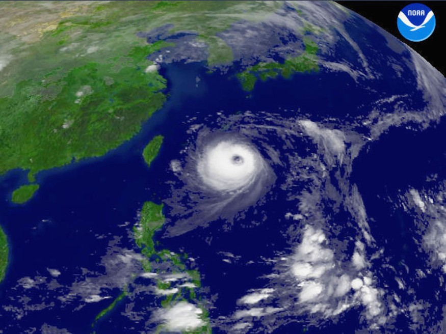
Typhoon Nanmadol made landfall near the city of Kagoshima, located on the southern tip of Kyushu on Sunday morning.
The island has a population of over 13 million people and is part of the four islands that make up the body of Japan.
The Japan storm had winds of at least 180 kilometers per hour (112 miles per hour) and was forecasted to bring 500 millimeters (20 inches) of rainfall on Sunday and Monday.
The Japan Meteorological Agency (JMA) stated Nanmadol will bring torrential rain and potential coastal flooding or coastal erosion due to storm surges along the coast.
Conditions were rapidly deteriorating by Sunday afternoon, adding that the wind has become extremely strong and the rainfall showers becoming heavier, an Izumi city official told AFP news agency, as cited by The Japan Times.
Strongest Storm of 2022
Typhoon Nanmadol pummeled through the Kyushu region on Monday after making landfall in Kagoshima Prefecture, downing power lines and causing the cancellation of hundreds of flights, as well as bullet train and ferry services.
Nanmadol was seen near the city of Fukuoka by Monday morning. It is expected to further dump heavy rain on most parts of Honshu on Tuesday, leading to flooding and landslides in Tokyo and its surrounding Kanagawa Prefecture, according to the JMA, as cited by The New York Times from local sources.
Many parts of Kyushu and prefectures in Northeast Japan remain under a flood warning.
Utility companies in Japan said almost 200,000 homes experience power outages by Sunday evening, BBC.
Nanmadol is the 14th typhoon in the Pacific this season, but is the largest to hit Japan this year, according to the UK media outlet.
© 2026 NatureWorldNews.com All rights reserved. Do not reproduce without permission.


