In the Pacific Northwest and New England, people should watch out for excessive rainfall on Sunday. Flooding is likely in low-lying areas in the region. For motorists, people should stay away from flooded roads.
The main threats are heavy rains, thunderstorms, hail conditions and flooding. Localized flash flooding and isolated tornadoes are possible. People with travel plans should check the forecasts due to severe thunderstorms.
NWS Weather Forecast: Where Will Severe Thunderstorms Unload?
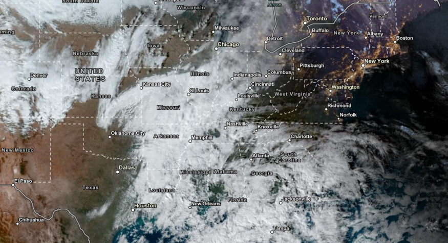
The National Weather Service (NWS) advisory warned of scattered severe thunderstorms from East Texas to Tennessee Valley, including in the Memphis and Mid-South.
On Saturday, potential thunderstorms and showers in the Ohio Valley, Great Lakes, Lower Mississippi Valley and Tennessee Valley. The Weather Prediction Center showed a slight risk of thunderstorms in the Southern Ohio, Tennessee Valleys and Mississippi Valley.
The strong winds can impact light vehicles and powerlines. Meanwhile, the isolated tornadoes can become more challenging during at night. On Sunday, thunderstorms can spread over the Mid-Atlantic, Central Gulf Coast and Southeast.
The heavy precipitation will also become beneficial in drought-stricken areas in Texas and Tennessee Valley, especially in the Mississippi River suffering from low water levels.
Furthermore, severe thunderstorms can also impact Southwestern Missouri, Southeastern Kansas and Central Arkansas. Hail can also unload in Little Rock, Fort Smith and Spring Field.
On the weekend, the threat of severe thunderstorms can occur in the following areas:
- Louisville
- Memphis
- Birmingham
- Jackson
- Shreveport
- Houston
- Lafayette
- Mobile
- Birmingham
- Nashville
- Louisville
- Detroit
- Indianapolis
- Chicago
- Jackson
- New Orleans
- Houston
- Atlanta
- Tampa
- Jacksonville
- Charleston
- Richmond
Pacific Northwest: Rain and High-Elevation Snow
The Pacific Northwest recently experienced the impact of atmospheric rivers and intense rainfall. A plume of moisture will likely become noticeable on Saturday, bringing flooding concerns to the region.
Homeowners should stay alert for high-elevation snow and rain, causing localized flooding. The forecast warned of intense rainfall and urban flooding on the weekend.
In the Eastern US, rounds of rain are likely on Saturday and until early next week in the following areas:
- Portland
- Boston
- Albany
- New York City
- Washington
- Virginia Beach
- Raleigh
- Atlanta
- Nashville
- Charleston
- Pittsburgh
Heavy rain can also spread in Memphis, New Orleans and Jackson. Homeowners should watch out for damaging winds on the weekend. Wind gusts can reach from 50 mph, especially on Monday. The strong winds can unload in Portland, Bangor, Boston and New York.
Related Article : Deadly Flooding in Northwestern US: Two Died Likely Due to Heavy Atmospheric Event
For more similar stories, don't forget to follow Nature World News
© 2026 NatureWorldNews.com All rights reserved. Do not reproduce without permission.


