The latest weather forecast warned that hazardous winds and a chilly outlook can unload in Colorado and Wyoming this late week, causing foggy conditions and cold-related health risks.
Colorado and Wyoming are no strangers to extreme cold and heavy snow. In Washington and Oregon, the recent NWN forecast warned of excessive rainfall in the region.
In the Northern Rockies and Cascades, residents can anticipate widespread cold this week. A strong cold front is likely to move to the east and south of the US.
In this week's weather, Colorado and Wyoming are threatened by heavy snow, freezing temperatures and widespread travel dangers. People in the said areas should stay updated with forecasts due to the challenging weather outlook this late week.
Colorado And Wyoming: Chilly Outlook With Strong Winds
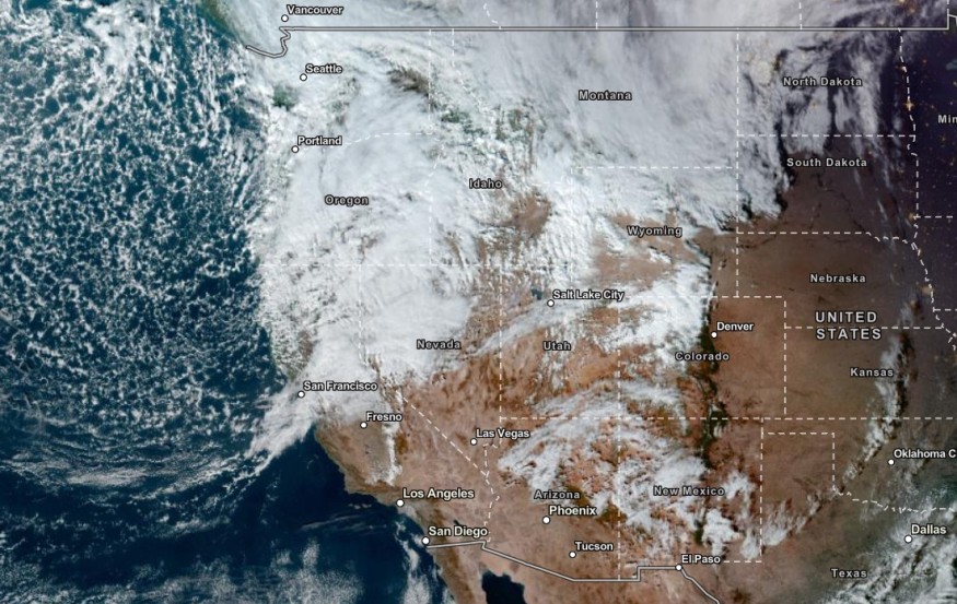
According to NWS Hazardous Weather Outlook, snowy outlook will unload in Wyoming this week, especially in the mountainous areas. The possible wind gusts can reach from 45 to 55 mph, including in the Southwest Wyoming and Continental Divide.
On Friday, more snow is expected. Homeowners should cover their crops and plants to avoid prolonged exposure to freezing outlook and snow. For Americans, plumbing is at risk of damage.
In parts of Northeast and North Central Colorado, homeowners should stay alert for High Wind Warning in the Foothills and Front Range Mountains. Challenging road conditions can unload in the Plains and Interstate 25.
In the Eastern Plains, the wind gusts can reach up to 45 mph on the weekend.
Due to the strong winds, elevated to near-critical weather concerns are possible this week. Spotty fire concerns are possible this week, especially for dry vegetation areas. Homeowners are advised to check for local burn bas and avoid fires that can spark raging wildfires.
In the late week, potential mountain snow can unload on Friday night with a chance of snowfall. On the weekend, the light snow will be more noticeable. The snow accumulations can reach from 3 to 7 this week, including in the Palmer Divide Region, Central Mountains, and Pikes Peak.
In parts of Utah, the forecast also warned of mountain snow and colder conditions.
Weather in Other Parts of the US: Severe Storms, Winter Warnings
On the other hand, severe storms are likely from the Mississippi Valley and Atlantic Coast this weekend. The rain will help with the drought-stricken Mississippi River with low water levels.
The NWS Salt Lake City UT warned of heavy snow in the Wasatch Mountains I-80 North and Wasatch Mountains South of I-80. Residents should monitor for Winter Storm Warning in the region.
The advisory reminded people to prepare for dangerous driving conditions and emergencies due to a stormy outlook.
Related Article : US Weather Forecast: Strong Winds, Winter Storm Warnings Present in Colorado, Wyoming
For more similar stories, don't forget to follow Nature World News
© 2026 NatureWorldNews.com All rights reserved. Do not reproduce without permission.


