Weather experts warned that Hurricane Tammy could bring structural damage over Lesser Antilles.
They said that the weather system is threatening the area with torrential rains as well as strong winds.
So far, hurricane warnings have been issued for part of the region as Tammy swipes the Lesser Antilles.
After bringing impact towards the island, the steering winds over the Atlantic are expected to keep Tammy to the east of the United States but weather experts said that potential impacts to Bermuda are still strong.
Hurricane Conditions
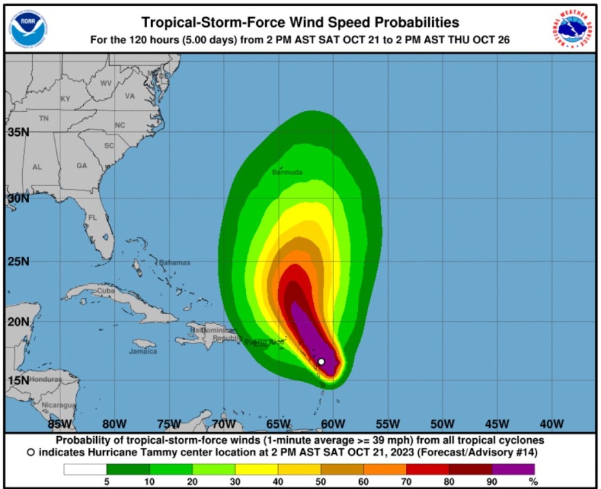
The National Hurricane Center and Central Pacific Hurricane Center said that at 800 PM AST (0000 UTC), the center of Hurricane Tammy was spotted near latitude 17.5 North, longitude 61.6 West.
Tammy is tracking the direction toward the north-northwest near 10 mph (17 km/h) and this general motion is expected through Sunday, and it would be followed by a turn toward the north on Monday.
Based on the forecast track, the center of Tammy will move near or over portions of the Leeward Islands tonight, and then it will track north of the northern Leeward Islands by Sunday afternoon.
Maximum sustained winds are near 85 mph (140 km/h) with higher gusts.
Meanwhile, slow strengthening is possible during the next few days.
On the other hand, Tammy's hurricane-force winds extend outward up to 25 miles (35 km) fromthe center and tropical-storm-force winds extend outward up to 125 miles (205 km).
Furthermore, the minimum central pressure estimated from Air Force and NOAA Hurricane Hunter aircraft observations is 989 mb (29.20 inches).
Meteorologists said that hurricane conditions are expected over portions of the northern Leeward Islands tonight. Tropical storm conditions, meanwhile, are expected within the tropical storm warning areas through tonight.
Tropical storm conditions are possible in the British Virgin Islands tonight and Sunday.
When it comes to rainfall, Tammy is expected to produce the following storm total rainfall in the following areas:
Leeward Islands: four to eight inches with maximum amounts of 12 inches; Martinique and Dominica: Additional two to four inches with maximum amounts of six inches; and British and U.S. Virgin Islands into eastern Puerto Rico: one to two inches with maximum amounts of four inches.
Weather experts said that these rains could produce isolated flash and urban flooding, along with isolated mudslides in areas of higher terrain.
On the other hand, storm surge could raise water levels by as much as one to three feet above normal tide levels near where the center of Tammy moves across the Leeward Islands.
Meteorologists said that near the coast, the surge will be accompanied by large and dangerous waves.
The surf swells generated by Tammy will continue to affect portions of the Lesser Antilles during the next few days. These swells are seen to cause life-threatening surf and rip current conditions.
Other Developing Storms
Tammy is seen to move away from the northern Leeward Islands early next week.
The weather pattern across the North Atlantic should steer the storm safely away from the US but Bermuda could encounter possible impacts
Meteorologists will also be monitoring trends of Tammy and if rain and wind could become more of a serious threat for the island nation.
They will also keep an eye on an area of disturbed weather that is expected to form soon in the southwestern Caribbean Sea.
Related Video:
© 2026 NatureWorldNews.com All rights reserved. Do not reproduce without permission.


