Weather experts said Hurricane Nigel has transformed into a rare type as it sways off the Atlantic.
They said that Nigel had developed a massive eye early this week as it continues its journey across the open waters of the central portion of the Atlantic.
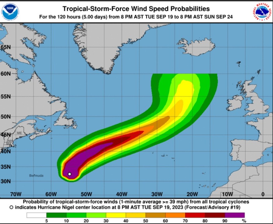
According to the National Hurricane Center and Central Pacific Hurricane Center, it was at 1100 PM AST (0300 UTC) when the center of Hurricane Nigel was spotted near latitude 33.2 North, longitude 54.7 West.
Nigel tracking the north
Hurricane Nigel is tracking the direction towards the north near 15 mph (24 km/h). A turn toward the northeast with an increase in forward speed is expected on Wednesday.
Meteorologists said that Nigel's maximum sustained winds are near 100 mph (155 km/h) with higher gusts. Furthermore, some additional strengthening is possible through early Wednesday.
On the other hand, Nigel's weakening is expected on Thursday and Friday. Nigel is also forecasted to become a strong post-tropical cyclone by Friday.
Hurricane-force winds extend outward up to 60 miles (95 km) from the center and tropical-storm-force winds extend outward up to 175 miles (280 km).
Weather experts said that the estimated minimum central pressure is 971 mb (28.68 inches).
As the weather disturbance is expected to move toward the north at 13 kt on the western edge of a mid-level ridge over the central subtropical Atlantic, meteorologists noted that by Wednesday, Nigel is likely to turn northeastward.
Nigel is also seen to accelerate in the flow of a deep-layer trough located over the northeastern United States and Atlantic Canada.
In the first few days, there is little spread in the track guidance envelope, and only minor adjustments have been made by meteorologists to the latest official forecast.
Nigel will also move poleward, meaning the extratropical low is forecasted to interact with a broader cyclonic circulation over the north Atlantic on the next days.
Based on the forecast, this will introduce and increased track uncertainty.
When it comes to the surfs, the swells generated by Nigel would affect Bermuda during the next couple of days. These swells are likely to cause life-threatening surf as well as rip current conditions.
Hurricane status
The opportunity for Nigel to become the Atlantic basin's fourth major hurricane is no longer likely, according to weather forecasters.
To be considered as a major hurricane, the weather disturbance should reach Category 3 status packing maximum sustained winds of at least 111 mph.
Despite the favorable environment with light winds and warm waters, dry air was being drawn into the storm's massive eye on Tuesday morning, which was putting a cap on its intensity.
As Nigel fights against the dry air, meteorologists observed that it is evolving into a rare breed of hurricane.
Nigel is becoming an annular hurricane or a hurricane with a large eye that is defined as a truck tire or doughnut.
Meteorologists said that common traits of annular hurricanes are the absence of outer rain bands and a lower risk of large fluctuations in strength.
These types of storms can also survive in slightly cooler waters than what is typical for tropical cyclones of around 80 degrees Fahrenheit.
Related Article : Hurricane Updates: Tropical Storm Nigel Poses No Threat to US This Week
Related Video:
© 2026 NatureWorldNews.com All rights reserved. Do not reproduce without permission.


