Millions of Americans were under winter weather warnings or advisories on Thursday as a storm blanketed the Midwest before moving toward the Northeast and pummeling Denver with the heaviest two-day January snowfall in more than 30 years.
The Northeast is expected to experience freezing rain and heavy snowfall. By Friday afternoon, 4 to 8 inches of snow are expected to cover the area from southern Maine to Vermont.
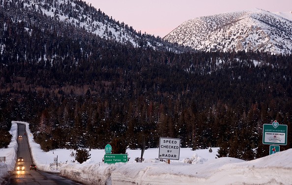
Large Storm Aims For Northeast
Mario Tama/Getty Images
Denver received 9.1 inches of snow from the storm, which also left its mark on the Midwest.
From Iowa to Michigan, snow fell early on Thursday, with the Upper Peninsula of Michigan receiving the most.
Parts of the Upper Midwest will continue to experience heavy, wet snowfall throughout the day. In Michigan, 6 to 12 inches of snow were predicted, with localized accumulations of 20 inches possible.
Snowfall on Thursday forced the Minneapolis-St. According to Jonathan Yuhas' tweets, the Paul area has received more than 50 inches this season.
That is roughly equivalent to an entire winter for the area and twice the average for the date.
According to AccuWeather, a tornado watch was in effect for more than 2 million people in the South.
According to Mark Pestrella, director of the Los Angeles County Public Works department, the 88 cities and 10 million residents of Los Angeles County have collected enough water from a series of storms over the last three weeks to supply about 800,000 people for a year.
Thunder and lightning were heard Thursday as the Upper Peninsula of Michigan experienced heavy snowfall since Wednesday night.
Thundersnow only occurs during prolonged snowfalls like the one currently occurring over the Upper Midwest.
Northern Ohio was under a severe thunderstorm warning from the Cleveland office of the National Weather Service, which included the possibility of tornadoes and wind gusts of up to 60 mph. Thursday, ET.
On Thursday, there may be 4 to 8 inches of snow in certain areas of Minnesota, Michigan, and Wisconsin.
The weather service warned that gusty winds of up to 35 mph would cause blowing snow and "near-whiteout conditions" during the heaviest snowfall.
According to the Appleton Post-Crescent, a member of the USA TODAY Network, the heaviest snowfall amounts in Wisconsin are predicted to be 5 to 8 inches for the central and east-central regions of the state, as well as 5 to 8 inches in Green Bay and Fox Cities. Up to 10 inches of snow could fall in northern Door County.
While rain is possible near the coast, the interior of the Northeast is receiving snow from the first of two winter storms that will hit the region this weekend, as per Fox News.
By Sunday, a second storm is predicted to arrive, increasing the likelihood of snowfall in the interior.
The most recent three-month outlook from NOAA's Climate Prediction Center (CPC) is available, and it seems that if you enjoy the cold, you're out of luck.
The CPC predicts warmer-than-average temperatures for the southern United States and much of the East Coast from February through April. Aim for the Northwest if you want it cold.