Geologists discovered a bigger island in Tonga due to an underwater volcanic eruption. However, the remnants of a previous island have submerged.
According to Tonga Geological Service, the new island by the name of Lateiki Island is about 100 meters wide and 400 meters long. The new island lies between Kao and Late in the Pacific island nation's northern Ha'apai group of islands.
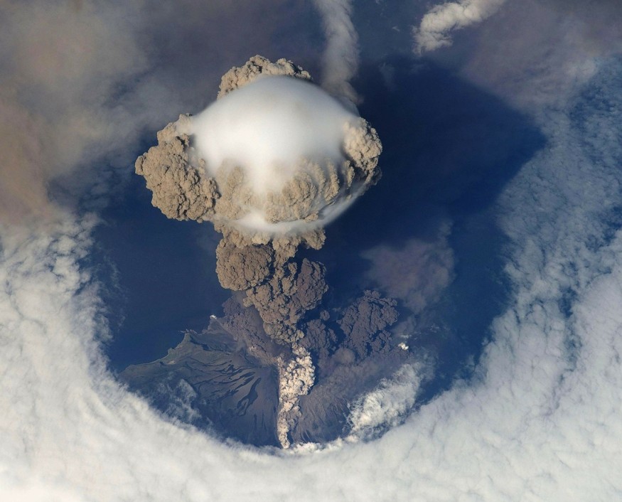
The southern part of Tonga also encountered a submersible volcano eruption and produced a new island two older islands in the archipelago, with a 400-foot (120-meter) summit in December 2014.
GeoNet released the satellite images of the phenomenon on Twitter which shows the elongated form of the island.
Since mid-Oct we’ve been tracking the #Lateiki (#Metis Shoal) #eruption with satellite imagery. By Nov 1 an elongated island has appeared at the main focus of activity. In the right most image we have combined the 1st and last images showing the 1995 dome appears to have gone. pic.twitter.com/tSukPm6car — GeoNet (@geonet) November 4, 2019
Lateiki, also known as Metis Shoal, previously erupted several times and has a reputation for creating islands. Tonga Meteorological Services (TMS) first discovered the latest eruption. Matafonua Lodge on Foa island, Ha'apai, and aircrafts from Real Tonga and Air New Zealand also reported the incident.
Potential Hazards
The report advised that although the eruption had ceased, Lateiki may still be emitting gas such as sulfur dioxide, carbon dioxide and hydrogen sulfide causing the discoloration of seawater.
Tonga is located on the famous Ring of Fire, a region of frequent seismic activity in the Pacific Ocean.
Researchers: The Island May Not Last Long
The new island created by the eruption of an undersea volcano in Tonga may not last long, according to researchers. Calculations recommend it could stay for six years or more, with the possibility to continue up to 25 years.
According to GNS Science volcano information specialist Brad Scott, explosions from the same undersea volcano, which rose about 1500 meters from the sea depths, produced other islands in the past.
Most of the islands were made of pumice and washed away.
Scott said the lava dome was there before the latest eruption; however, the dome had now disappeared. The researcher could only assume what happened to the dome.
"Probably sort of collapse of the summit of the volcano in the new eruption, but that's just a guess," Scott said. He added he was unaware of any pumice raft following the October eruption.
The volcano eruption was among many submerged volcanoes in the plate boundary in the area. Another volcanic activity happened about 60 to 70 kilometers away produced a pumice raft of about 60 sq. km. in August.
Eruptions during the months of August and October provided a geological hazard monitoring system named GeoNet with the chance to examine satellite analysis data tools.
GeoNet would be used to track any pumice raft, and anticipate where it might drift if a submarine eruption happened closer to New Zealand, according to GNS remote sensing scientist Dr. Salman Ashraf.
© 2026 NatureWorldNews.com All rights reserved. Do not reproduce without permission.


