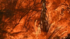
California wildfires
-
Wildfire Map: US Government Outlines 11 California Counties Most at Risk of Raging Wildland Fires
Although wildfires are common in California, the wildfire map was created to show the counties most susceptible to wildland fires.
Latest Research Articles
-
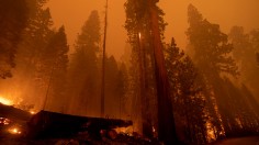
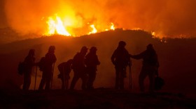
Wildfire Blazing in California’s Sierra Nevada is Threatening World's Largest Trees
-

Climate Crisis Triggers Wildfires, Prompting Biden to Advocate for a Rebuilding Plan
-

Bears Breaking Into Homes: After Escaping From Wildfire, California Residents Face New Threat
-
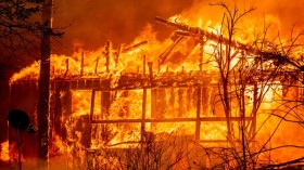
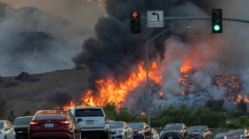
Dixie Fire: Catastrophic California Wildfire Burning for 22 Days Leaves Town in Ruins
-
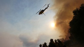
Two Crew Members Dead as Uncontrollable Wildfire Continues to Blaze in California
-
Red Flag Warning: Some Parts of California at Risk of High Fire Danger Weather
-
California Wildfire’s Thick Smoke Spreads Across the Planet
-
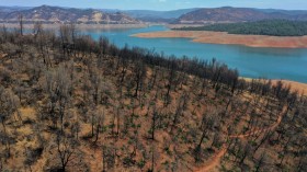
California Wildfire Destroyed 10,000 Redwood, Killing Off 10% of World's Sequoia Population
-
Low Temperatures and Rain Can Help Battle California Wildfires
-
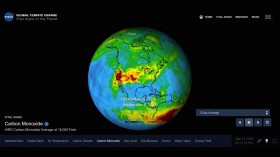
NASA Satellite Shows Carbon Monoxide Released from California Wildfires 10 Times Normal Concentrations
-
ULA Delays Launch of WorldView-4 Satellite Due to California Wildfires
-
2016 Is A Year Of Extreme Weather Disasters For The U.S.
most popular
-

Animal Captivity Ban: Costa Rica to Close State Zoos and Prohibit Caged Wild Animals Following 11 Years of Litigation
-

Bird Flu Outbreak: Cow Milk May No Longer be Edible Following Detection of Avian Influenza Pathogen in Colorado Dairy Cattle
-
Plains Weather Forecast: Isolated Tornadoes, Flooding Rain to Threaten Next Week
-

Pig Kidney Transplant: First Person to Receive Kidney from Genetically Modified Pig Dies 2 Months After Procedure
-

North America's Butterflies, Bees Suffer from Population Decline Due to Climate Change, Habitat Loss