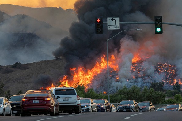
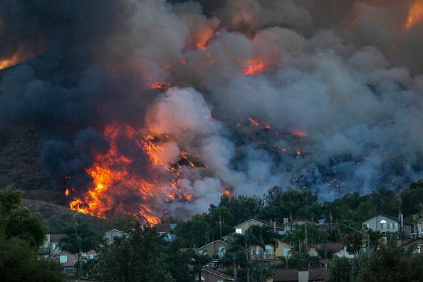
The National Weather Service issued a red flag warning Tuesday, giving a signal that the high-danger fire weather is on its way as gusty winds and disturbingly low humidity levels extend across the eastern Sierra Nevada mountain range to western Colorado.
Red Flag Warning
According to NWS meteorologists based in Reno, the red flag warning will stay in effect until 11 p.m. Tuesday evening and will begin on Wednesday. Red flag warnings are the highest alert of the agency and are used to indicate the possibility of extreme fire behavior.
The critical fire weather is anticipated to sweep across five states. In California, meteorologists forecast southern Mono County and Alpine County to be the location that will be affected the most by wind gusts up to 45 mph and humidity levels less than 15%.
An NWS meteorologist in Reno, Edan Weishahn said: "If a fire were to begin, it would spread rapidly, we want to give the public a forewarning that they need to be very careful." Weishahn said anyone pulling a trailer is urged to stow the trailer chains, which normally spark fires along roadways.
Meteorologists are also asking the public to steer clear of driving in dry grass and postpone target shooting.
Also Read : Over 80 Percent of All Wildfires in the Past 20 Years Were Caused by Humans, Study Shows
Fire Danger
Fire danger is a description of the joining of both variable and constant factors that affect the trigger, spread, and ease of managing a wildfire on an area.
Most systems and schemes make attempt to provide precise and reliable forecasts of fire danger; analyze the fuel, weather, and topography; and combine their effects into a set of numbers that fire managers can use to meet their needs.
Fire managers make use of the National Fire Danger Rating System (NFDRS) to input data and to get information used to detect fire danger in their area. Based on the fire danger, managers may introduce restrictions or shutting down of public lands, plan for or pre-position staff and equipment to combat new fires, and make decisions whether to subdue or let fires burn under prescribed conditions.
Fire Danger Levels
LOW (GREEN) - Fire starts are not likely. Weather and fuel conditions will bring about slow fire expansion, low intensity, and somewhat easy control with light mop up. Managed burns can often be executed with reasonable safety.
MODERATE (BLUE) - Some wildfires may be anticipated. Expect average flame length and rate of extension. Control is usually easy and light to moderate mop up can be anticipated. Although controlled burning can be done without causing a hazard, regular caution should be taken.
HIGH (YELLOW) - Wildfires are probable. Fires in heavy, persistent fuel, like mature grassland, forest litter, and weed fields will be hard to control under windy conditions. Control through direct attack may not be easy but achievable, and mop up will be needed. Outdoor burning should be cramped to early morning and late evening hours.
For more news, updates about fire dangers and similar topics don't forget to follow Nature World News!
© 2026 NatureWorldNews.com All rights reserved. Do not reproduce without permission.


