The latest weather report warns of a severe weather outlook in the south-central Plains, causing isolated tornadoes, damaging winds, hail, and heavy rains.
A National Weather Service (NWS) monitors the development of an active weather pattern in the Plains, Great Lakes, and Ohio Valley. Additionally, the severe outlook can occur in parts of the Lower Missouri Valley.
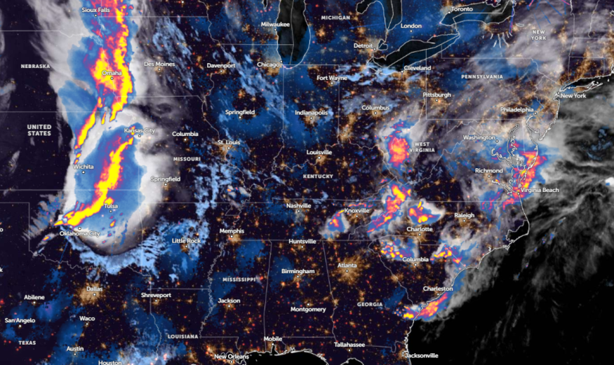
Daily commuters should keep alert for heavy rains and flooding risks this week, particularly in the Northern High Plains and eastern parts of Central to Southern Plains.
South-Central Plains Severe Weather Conditions
The NWS forecast for Tuesday shows thunderstorm activity in the Great Lakes, Mississippi Valley, and Ohio Valley. In the Plains, there is a moderate to high risk of severe weather, with strong winds and tornado concerns.
Challenging weather conditions, with heavy rains, can occur in the following areas:
- Eastern Nebraska
- Eastern Kansas
- Northeast Oklahoma
- Western Missouri
- Iowa
- Northeast Wyoming
- Eastern Montana
- Texas
The latest advisory in Kansas City notes a potential line of storms in the region, with damaging wind gusts reaching 75 to 80 mph. A Severe Thunderstorm Warning was present in Tarkio, MO, Rock Port, MO, and Mound City, MO.
Additionally, rain potential can unfold in the Mississippi Valley, with severe storms in midweek. Motorists can experience slower commutes or hazardous travel due to the weather outlook.
In the southern Plains, another concern is the low relative humidities and windy outlook, which could cause potential fires. Critical fire weather threats can occur in Colorado, Texas, Oklahoma Panhandle, and New Mexico.
For outdoor enthusiasts, outdoor burning should be avoided until the weather improves.
In midweek, the latest severe thunderstorm forecast warns of hail, localized damaging winds, and isolated tornadoes. Poor weather outlook can unload in the following areas:
- Madison
- Chicago
- Peoria
- St. Louis
- Springfield
- Fort Smith
- Little Rock
- Jonesboro
- Nashville
- Evansville
- Indianapolis
- Columbus
- Charleston
- Cleveland
In St. Louis, residents are warned of severe storm potential on Wednesday. The forecast indicates that very large hail, damaging winds, and isolated tornadoes are likely.
Meanwhile, NWS Nashville advises residents of a few thunderstorms, including heavy rains and gusty winds. Travelers must check for severe thunderstorm advisory before commuting this week.
This coming weekend, residents can expect relief from severe weather.
Read also: Utah & Colorado Weather Forecast: Storm System Likely to Bring Scattered Showers, Thunderstorms
Weather Outlook in Central to Northern Rockies
On the other hand, Central to Northern Rockies can anticipate late-season winter weather threats, potentially impacting portions of Utah, Wyoming, and Colorado.
It can trigger late-season heavy snow, and homeowners should stay alert for winter storm warnings or winter advisories this week. The snowy outlook can lead to cold-related health risks and hazardous travel.
Limiting unnecessary travel this week should be avoided until the weather improves in parts of the U.S.
For more similar stories, don't forget to follow Nature World News.
© 2026 NatureWorldNews.com All rights reserved. Do not reproduce without permission.


