A National Weather Service (NWS) forecast shows that scattered showers and thunderstorms can unload in Utah and Colorado this week. In Wyoming and Nebraska, homeowners can expect stronger winds.
In nearby areas, the western US can anticipate a cold weather outlook and windy conditions. Heavy mountain snow can also occur. Meanwhile, severe thunderstorms can threaten portions of the Great Lakes and Ohio Valley.
In addition, an NWS weather report on May 5 shows that rain and higher-elevation snow could unload in the western U.S. Critical fire weather concerns can occur in the Desert Southwest.
Weather in Colorado and Utah
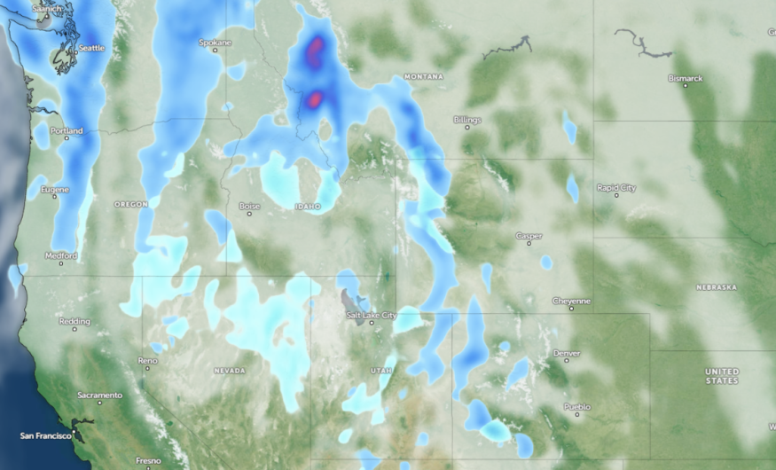
According to a weather report, parts of Colorado and Utah can expect potential thunderstorms and showers this week. The forecast shows strong winds and low-pressure systems are possible, and wind gusts could reach up to 65 mph in the valleys.
The pressure system can unleash widespread precipitation in the region. Mountain snow may accumulate in the central and northern Colorado mountains.
In north and north-central Colorado, a windy outlook could continue in the mountains and plains. Commuters should watch out for isolated showers and light snow, which could cause potentially slippery roads or hazardous travel.
From Monday through Saturday, the storm system can unleash breezy to windy conditions on Monday or Tuesday. In Lincoln County, the dry outlook could result in possible fire weather dangers due to wind conditions.
Weather Conditions in Wyoming
Additionally, residents in Wyoming can anticipate strong winds. On Monday, the cool and rainy outlook can unload in the eastern Natrona Counties. The accumulating snowfall can spread over the Sierra Madre and Snow range.
Meanwhile, western Nebraska residents should watch out for the elevated winds through midweek. In western Dakota and northeastern Wyoming, there is a chance of scattered thunderstorms.
Due to the hazardous weather outlook, limiting outdoor plans is advisable, especially when travel is not essential. Motorists should also keep updated with the latest road conditions in Colorado, Utah and Wyoming.
Weather in Other Parts of the U.S This Midweek
The weather advisory for San Diego predicts a chilly outlook and clear skies. This will be ideal for outdoor plans, but commuters should be alert for changing weather conditions.
For Los Angeles residents, beach hazards were issued in the city, particularly in the LA and Ventura counties. Beachgoers should keep alert for dangerous rip currents. There is also a rain potential this week.
The recent forecast for Salt Lake City shows that low temperatures on Wednesday can lead to a freezing mark in some areas. Homeowners are advised to cover their plants and watch out for cold-related health concerns.
In Flag Staff, a rainy outlook and high-elevation snow are likely in the region. Due to the potential slick travel outlook, Commuters should drive slowly.
For more similar stories, don't forget to follow Nature World News.
© 2026 NatureWorldNews.com All rights reserved. Do not reproduce without permission.


