Heavy snow and colder temperatures are possible in the Cascades, Rockies and Intermountain West, according to the National Weather Service (NWS) latest advisory.
In the Pacific Northwest, people dealt with the challenging cold and heavy rain due to the impacts of heavy atmospheric river in the region. Flooding became more concerning due to more precipitation and snowmelt.
In addition, the locally heavy snowfall can affect travel safety in the affected areas. Motorists had to face slippery travel, foggy conditions and ice-covered roads.
In this week's weather, the added concern is cold-related health risks, including hypothermia and frostbite. In the mountainous areas, hikers should watch out for winter-related warnings and dangers due to the heavy snow outlook.
NWS Weather Forecast: Where Will Heavy Snow Unload?
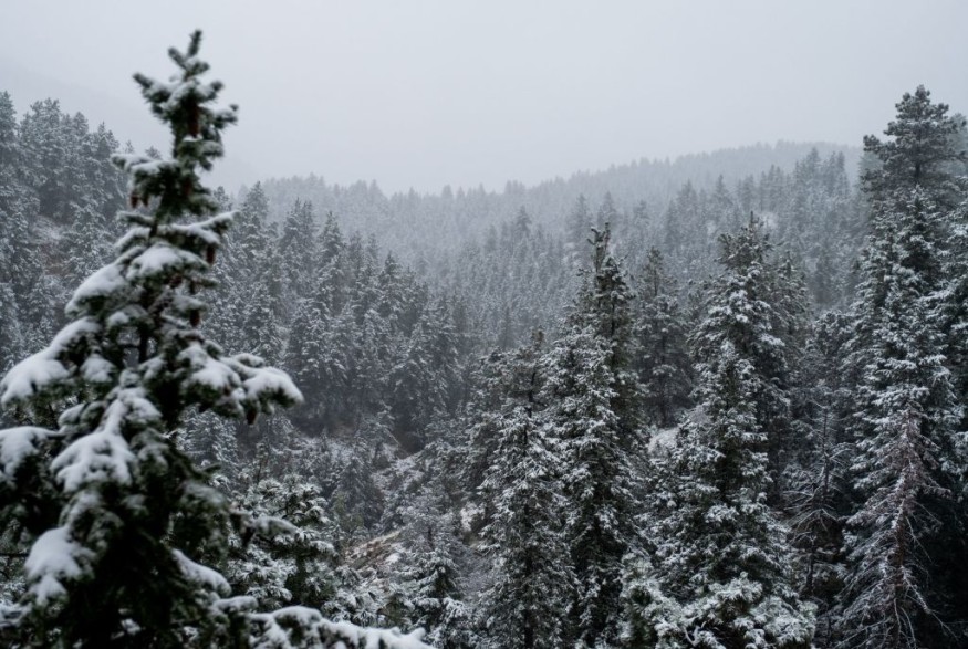
The National Weather Service (NWS) warned of heavy snow in the Cascades, Northern Rockies and Sierra Madre. Homeowners should stay alert for Winter Weather Advisories in the region.
In the Northern High Plains, winter weather and blowing snowfall are possible in the region. The chance of below-average temperatures is possible, including in the Continental Divide.
The potential snowfall can reach from 1 to 3 inches this late week as a strong cold front arrives. Homeowners should check for the unsettled weather outlook with blasts of heavy snow, causing hypothermia and frostbite.
Stormy Outlook in the Eastern Half of the US
Meanwhile, the latest forecast warned of massive weekend storms in the Eastern portion of the US this Saturday. People with travel plans should check the weather as 180 million Americans are at risk of heavy precipitation and damaging winds.
On Saturday night, the stormy weather is expected in the following areas:
- Chicago
- Detroit
- Indianapolis
- Jackson
- Houston
- New Orleans
Potential snow is also likely in the late week, including in the Northern Plains and Upper Midwest. Snowfall can unload in Fargo, Northern Wisconsin, the Upper Peninsula of Michigan and Western Minnesota.
On Sunday, the snowy outlook can spread in Erie, Pittsburgh, Charleston and Montreal. Colder temperatures can unload in Green Bay, Chicago and Nashville.
Meanwhile, more rain will be likely in Boston, New York, Atlanta and Washington, Boston, Albany, Raleigh, Charleston, Pittsburgh and Buffalo. Low-lying areas are at risk of small to severe flooding, according to news reports.
However, the heavy rain will help drought-impacted areas in the Eastern portions of the US. For motorists, it is not advisable to travel on flooded roads, especially for lightweight vehicles.
For more similar stories, don't forget to follow Nature World News
© 2026 NatureWorldNews.com All rights reserved. Do not reproduce without permission.


