Meteorologists said that two weather systems are being monitored in the Atlantic Ocean.
According to weather forecast, these weather systems could bring effects to the land area.
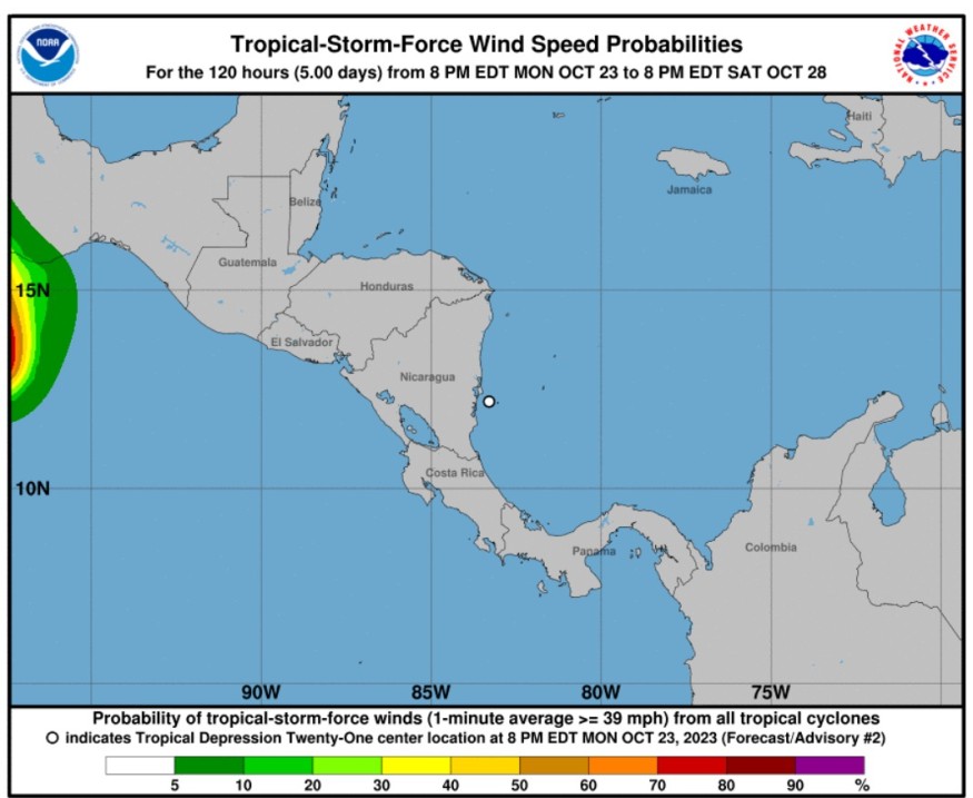
Tropical Depression 21
The National Hurricane Center and Central Pacific Hurricane Center said that at 1100 PM EDT (0300 UTC), the center of Tropical Depression 21 was spotted near latitude 12.4 North, longitude 83.4 West.
The tropical depression is moving toward the northwest near 5 mph (7km/h) and this motion is expected to continue tonight.
Based on the forecast track, the tropical depression will move inland over the next few hours over eastern Nicaragua.
Furthermore, maximum sustained winds are near 30 mph (45 km/h) with higher gusts.
Weather experts said that there would be little change in strength is forecast. The tropical depression is forecasted to dissipate inland over Nicaragua tomorrow.
The estimated minimum central pressure is 1007 mb (29.74 inches).
When it comes to the amount of rains, the tropical depression is expected to produce additional rainfall totals of four to eight inches with maximum amounts of 12 inches across Nicaragua and two to four inches with maximum amounts of six inches across southern and eastern Honduras.
These rains are likely to produce flash and urban flooding, along with mudslides in areas of higher terrain.
Weather experts said that the tropical depression should quickly weaken and dissipate.
However, its significant to note that if the center is still over water and it would remain there for any period of time overnight, some slight strengthening could occur since the environment is otherwise favorable for intensification.
The long-term estimated motion is around 310/4 kt, but this is highly uncertain. The depression, or its remnants, are also forecasted to continue northwestward tonight, and then it would generally head westward toward the eastern Pacific after that.
Hurricane Tammy
Weather experts said that Hurricane Tammy is churning towards north of the Leeward Islands. It is also seen to be moving over the open Atlantic waters.
They said that Tammy is a compact Category 1 hurricane with maximum sustained winds of 80 mph, tracking the direction toward the northeast of Puerto Rico.
Furthermore, it would continue to track to the north over the next few days as it moves away from the Caribbean region.
Meteorologists also said that they would continue to closely monitor the latest trends and analyze the path Tammy will track over the next seven days.
They could not, however, determine which direction the storm may travel at the moment.
Tammy is also predicted to maintain hurricane strength through at least midweek, however, it an lose wind intensity throughout the day on Thursday.
This is because Tammy would encounter strong wind shear, or disruptive winds in the atmosphere that can affect tropical cyclone organization.
Moreover, later this week into this weekend, weather forecasters said that the impacts from Tammy may be felt across the islands of Bermuda.
The primary effects from Tammy across Bermuda will be heavy downpours, gusty winds and rough surf.
Related Article : Hurricane Tammy Pummels North Caribbean with Large Waves, Heads Toward US by End of Week
Related Video:
© 2026 NatureWorldNews.com All rights reserved. Do not reproduce without permission.


