An ice storm is threatening a large swathe of areas from Texas to the Tennessee Valley and Lower Ohio Valley this week, according to the National Weather Service (NWS).
This comes as the powerful blow of Arctic air combined with a surge of moisture is setting a precedent for an intense and life-threatening ice event.
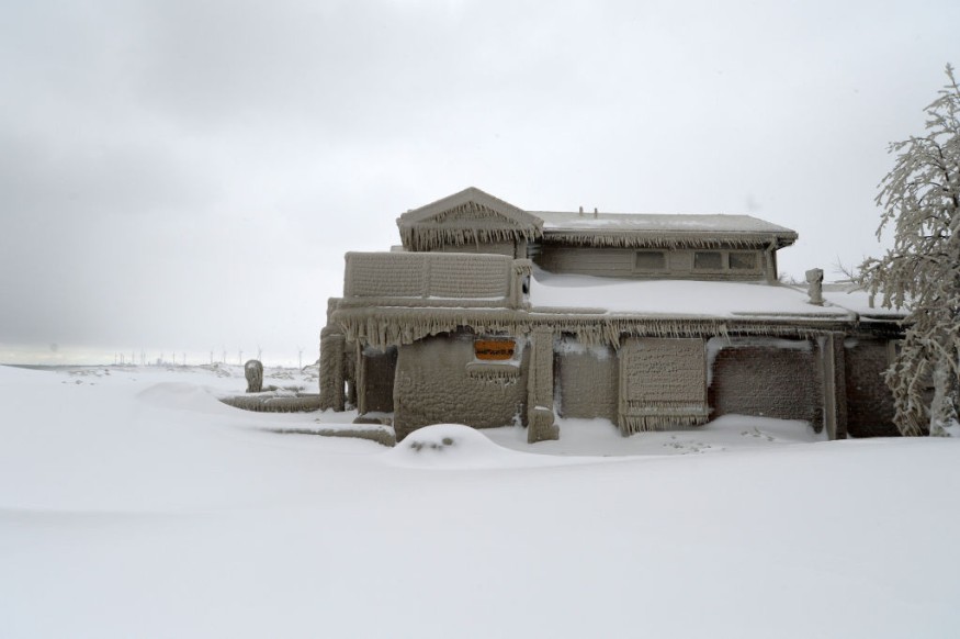
Based on previous forecasts, the storm will impact of South US and head to Northeast US.
As of early week, million of Americans are reportedly under winter storm alerts, including watches, warnings, and advisories.
These alerts meant that residents in certain areas are already dealing or will experience winter weather hazards like heavy snow, wind chills, and cold temperatures.
In addition, power outages and disruption to travel are also possible in the coming hours and days.
NWS Forecast
The NWS, through its Weather Prediction Center (WPC), on Monday, January 30, updated its short-range forecast for this week by stating a "prolonged and potentially significant icing event" will impact a vast area from the Southern Great Plains to the Tennessee Valley.
In addition, the prediction center also highlighted the continuance of frigid temperatures over the Central US and Western US from early week.
On the other hand, heavy rain and flash flooding are possible across eastern Texas and the lower Mississippi Valley on Wednesday, February 1.
The latest NWS forecast on Monday is not the first time.
In fact, the US weather agency has been monitoring the moving Arctic air mass into the Continental US since the weekend.
More than a month after a historic winter storm struck the country in late December of 2022, the ongoing weather system is a sign the winter season is far from over.
US Winter Storms
On Sunday, January 29, a "triple threat of winter storms" was raging towards the central US, with the potential to cause travel disruptions throughout the week as the northern tier of the country, including the Upper Midwest, saw cold temperatures and wind chills that could reach negative 50 degrees, USA Today reported.
In a video report, The Weather Channel Meteorologist Domenica Davis said the winter storm is expected to bring heavy snow and significant ice threat across the country as the Arctic air surges into the Central US with dangerous wind chills.
Up to below 30 degrees temperatures could be seen in the Northern Plains and Midwest as extreme cold is further expected from Tuesday, January 31, until later this week, based on the meteorologist's wind chill forecast.
Arctic Air Threat
The extremely cold Arctic air, also referred to as the Arctic cold front by meteorologists, returned to the US and across North America over the weekend.
The NWS reiterates that the Arctic cold is responsible for the wintry conditions across the Southern Plains and Mid-South, as the system continues to move slowly in a southward pattern.
The agency added multiple rounds of heavy rain is expected for across eastern Texas and Louisiana on Wednesday as a lower pressure area develops along the country's boundary.
© 2026 NatureWorldNews.com All rights reserved. Do not reproduce without permission.


