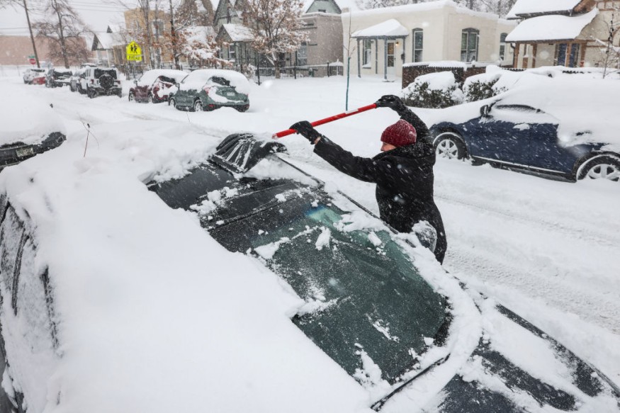
As the second storm of the week makes its way across the United States, conflicting temperatures will bring severe winter weather to the region, with ice posing a threat.
It may sound familiar in light of a storm that dumped a wintry mix and heavy rain throughout the United States earlier this week. In a lot of ways, it is.
On the other hand, the latest storm is bringing far more ice. The storm's ice accumulation totals pose a severe hazard to travel and infrastructure in the Midwest to the Northeast.
A long duration winter storm will begin today across the Southern Plains and then stretch as far as New England by Friday. A mixture of snow, sleet, and freezing rain is expected, some of which will be heavy. Significant impacts to travel are likely in many areas. pic.twitter.com/7ajfJKzeXb
— NWS Weather Prediction Center (@NWSWPC) February 23, 2022
"Ice accumulations of more than 0.25" are expected from Texas' Red River Valley to the Ozarks and southeast Missouri." Damaged ice of 0.5" or more is likely locally, resulting in scattered power outages, tree damage, and hazardous travel, according to the Weather Prediction Center (WPC).
Covering US with Ice
The south-central United States is in the crosshairs for ice buildup, with up to three-quarters of an inch of ice expected throughout northeast Arkansas on Thursday, posing a hazard.
The National Weather Service (NWS) office in Little Rock warned that travel might be almost impossible.
Even though it doesn't feel like today, the Northeast isn't out of the woods, as a similar wintry combination is expected to hit them on Friday.
Heavy snow and considerable ice are forecast as the system passes over the Great Lakes area late Thursday and into southern New England early Friday.
Related Article : Snow Quall Warning Keeps Everyone on the Edge
Ice Accumulation
Ice accumulations of up to a quarter-inch are possible in south-central Pennsylvania and western Maryland. Although they are better used to cold weather, the WPC cautioned that "widespread dangerous travel and damage to the electrical system are likely."
Much of the Northeast and southern New England are forecast to get six inches or more of snow, with parts of Massachusetts getting nearly afoot. Boston is expected to receive roughly nine inches of snow by the end of the week.
New York City is expected to receive around two and a half inches of snow on Thursday night, with a wintry mix and rain on Friday.
Raising Warnings
The Center warned that "hazardous avalanche conditions prevail in the backcountry, with heavy snow and high winds resulting in natural avalanches." Windy conditions will make it feel considerably colder than it is.
Windy conditions will make it feel considerably colder than it is.
Wind chill advisories and warnings affect more than 10 million people across 14 states. Wind chills reaching from -30 to -50 degrees are causing life-threatening conditions over the Plains.
The NWS at Bismark, ND, warned that "the extremely low wind chills could induce frostbite on exposed flesh in as little as 10 minutes." On the other hand, temperatures on the East Coast are telling a different picture.
"Ice storms happen when warm, humid air and cold air try to occupy the same real estate," CNN meteorologist Chad Myers explained. "The frigid Arctic air is significantly heavier than the buoyant warm air coming up from the south. That warm air rides over the cold air like packages going up a conveyor belt. The clouds make rain, but it freezes as it falls or hits the below-freezing ground."
Temperatures
Warmer temperatures at the surface on the storm's southern flank may cause heavy rain to emerge over the lower Mississippi and Tennessee valleys, posing a danger of localized flooding.
Thursday morning, heavy rain of two to three inches is forecast, moving eastward into the Ohio Valley later in the day. According to the WPC, cities, highways, and streams are the most vulnerable to flash floods.
The system is forecast to pass off the coast early Saturday, capping up an eventful week for the United States but leaving a sharp chill in the air.
For most recent weather news, don't forget to follow Nature World News!
© 2026 NatureWorldNews.com All rights reserved. Do not reproduce without permission.


