Residents in the Southern U.S would feel some relief after experiencing summerlike temperatures last week.
The temperatures in the United States have been on a rollercoaster ride, from warm to a sudden shift to the early taste of winter.
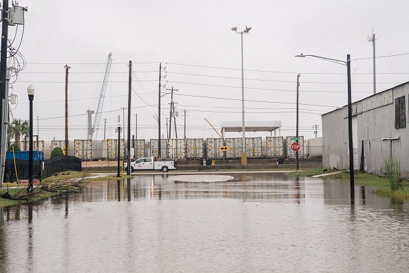
However, the rain is expected to come from severe weather in some areas in the Southern U.S and could look into localized flooding.
Meanwhile, Tropical Storm Roslyn has strengthened into a Hurricane that would unleash heavy rains and strong winds in portions of Mexico.
Category 3 Hurricane Roslyn could help add moisture to the severe storm, allowing rainfall in drought-stricken areas in Texas and Mississippi.
While some areas in the United States in eastern and northeastern U.S. have felt the early arrival of winter and temperatures started to cool down, parts of the Northwest and Midwest are reported for a rebound to warm temperatures.
According to AccuWeather's latest weather update, the severe storm, which resulted in snow accumulation in the Rockies, would impact portions of the southern United States starting Monday.
The report noted that the U.S Drought Monitor said that Texas and Oklahoma have been experiencing moderate to extreme drought, affecting farming and residents.
The rainfall from the storm would help alleviate the heat and drench drought-stricken areas.
The rain is also expected to help the long drought in the Mississippi River.
According to reports, the drought in the Missippi River would have no significant changes this year. Farmers who depend on the river have been much-affected.
Rainfall and localized flooding

The report added that the severe thunderstorm from Monday to Monday night could result in isolated tornadoes and damaging wind gusts, including in Dallas, San Antonio, and Houston.
Meanwhile, residents in the said areas should expect stormy weather that could cause a flash flood, reduced visibility, and travel delays.
Based on AccuWeather's forecast, the areas that the storm will impact are the following:
- Starting Monday, Oklamaha and Dallas would expect gusty thunderstorms. Meanwhile, Houston would have rain and thunderstorms, and El Pasa could see rain showers.
- On Tuesday, eastern Missouri, northeastern Texas, and portions of Oklahoma could experience one to two inches of rain.
- The report also added flashflood risks starting Monday to Tuesday night. Areas in Oklahoma, St. Louis, and Jackson should expect the heaviest rainfall, while local downpours in Houston and San Antonio areas.
- From Tuesday to Tuesday evening, flash flooding, torrential downpours, and high wind gusts could expect in parts of Memphis and Jackson.
Severe weather preparations
The forecasts noted that the stormy weather could result in heavy rains to localized flash floods. Residents should stay updated with the weather developments.
- The storm could result in reduced visibility on major roads. It is best to reschedule your outdoor activities when the storm starts to wane.
- Residents near the coasts should watch out for potential flooding and flash floods.
- Expect travel delays due to the impact of the storm. Stay updated with the announcements.
Related Article: Severe Thunderstorms Threaten Central US, Might Soak Until Tuesday
For more similar, don't forget to follow Nature World News.
© 2026 NatureWorldNews.com All rights reserved. Do not reproduce without permission.


