According to AccuWeather meteorologists, a complex storm system will travel from the Gulf Coast, across the Northeast, and into Atlantic Canada on Friday and Saturday, bringing snow, ice, pounding winds, and heavy rain to the eastern United States.
Affecting Millions
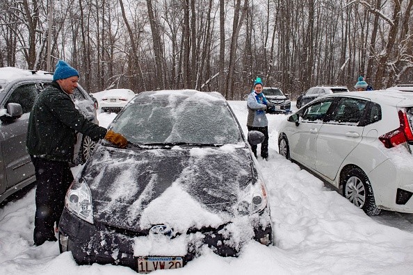
Reports claim that more than 150 million people will be affected by the storm east of the Mississippi River. Still, the Northeast, which received accumulating snow on Wednesday following record-breaking warmth on Monday, will bear the brunt of the effects as the storm rapidly strengthen into a bomb cyclone along the Eastern Seaboard.
When the atmospheric pressure in the core of a storm drops by 0.71 of an inch of mercury or more in less than 24 hours, it becomes a bomb cyclone or undergoes bombogenesis. The central pressure is expected to drop close to 1 inch of mercury from Friday evening to Saturday evening, indicating that this storm will likely surpass that requirement.
As of Thursday, winter storm advisories and watches were in force for parts of 11 states, ranging from the Tennessee Valley to New England. Some winter storm watches across a stretch from northeastern Mississippi to Vermont had been elevated to winter storm warnings by Friday morning.
Intensifying
According to Senior Meteorologist Dave Dombek, a fast-moving and swiftly intensifying storm will bring strong weather and dramatic weather changes to the country's eastern half, with the biggest extremes in store for the Northeast.
Major traffic difficulties are expected on the roadways and for those flying. Flight delays and cancellations are expected, with potential consequences across the country.
According to Chief On-Air Meteorologist Bernie Rayno, the storm will have two different sides in terms of temperature and weather. According to Rayno, warm air, regions of heavy rain, urban floods, severe thunderstorms, isolated tornadoes, and coastal flooding will be connected with the eastern part. On the other hand, the storm will collide with cooler air, causing temperatures to plummet over the interior. Heavy snow, whiteouts, and isolated blizzard conditions will result, as well as a quick freeze-up.
Duration
Although the snow phase of the storm is only expected to last 8-12 hours, and maybe only a few hours in certain regions, the effects will be considerable.
On Friday evening, the storm will form over the central Gulf coast before turning north-northeast and moving up the Eastern Seaboard on Saturday. Later this weekend, its route will carry it into Atlantic Canada.
The dividing line between the warm and cold impacts will form along the spine of the Appalachians as it makes that journey.
Coverage of Storm
Travel in this zone will be hazardous due to the freeze-up alone, and analysts advise that people avoid traveling if at all possible.
Snow will build on the roadways, and slushy parts will freeze due to a combination of plummeting temperatures from the 30s to the 20s, and even the teens F in some regions. Snow is expected to fall at a pace of up to 1-3 inches per hour, resulting in whiteout conditions. As the storm intensifies, snow will stick around for longer in northern locations, causing additional snow to accumulate.
Heavy snow will begin on Friday night and continue through Saturday, making hazardous conditions. According to meteorologists, this sort of situation can result in automobiles sliding off roadways, severe pileup accidents, or motorists becoming stuck on highways.
In certain regions, the heavy snowfall may be accompanied by thunder.
Forecasters warn that the storm's threats won't disappear once the snow melts. As temperatures drop into the teens and even single digits from the Appalachians on Saturday night to the interior Northeast on Sunday night, the storm will bring blowing and drifting snow.
For more climate and weather updates, don't forget to follow Nature World News!
© 2026 NatureWorldNews.com All rights reserved. Do not reproduce without permission.


