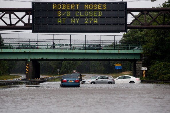
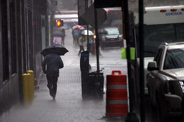
Closely after the intense rainfall and widespread flooding that took place last week in the tri-state, another round of heavy rain in the forecast through Tuesday morning has led to the issuing of a flash flood watch.
Flash Flood Watch
The National Weather Service issued the watch for southern Connecticut, New York City, central New York, and northeast New Jersey before another round of rain and storms moves into the region.
Storms develop Monday afternoon and there is a possibility the storm could be accompanied by 2 to 3 inches of rainfall by Tuesday morning. Many of the same regions that witness severe flooding last week could be vulnerable again, Storm Team 4 says.
There are chances powerful thunderstorms will strike Monday evening and into the late hours, some will possibly become severe.
Almost every day this week, those in the tri-state could witness storms. Once those eventually die down, temperatures will spike back into the upper 90s, Storm Team 4 says.
Factors that Contributes to Flash Flooding
There are some factors that contribute to flash flooding. Rainfall intensity and duration are the the two main elements. Intensity is the rate of rainfall while duration is how long the rain lasts. The following also play an essential role in flash flooding: soil conditions, topography, and ground cover.
Flash floods take place within a few minutes or hours of intense rainfall, a levee or dam failure, or when a sudden release of water is held by an ice jam. Flash floods can lead to tearing out trees, roll destruction of buildings and bridges, and scouring out of new channels. When water rises rapidly it can get to heights of 30 feet or more.
Also, rains that produces flash flood can also prompt catastrophic mud slides. Normally, you will not frequently have a warning that these dangerous, sudden floods are on their way. Most flood-related deaths are caused by Flash floods.
Rainfall
Most flash flooding is brought about by slow-moving thunderstorms, thunderstorms that repeatedly moves over the same region, or intense rains from tropical storms and hurricanes.
Sometimes, floating debris or ice can pile up at man-made or a natural obstruction and limit the flow of water. Water restrained by the ice jam or debris dam can bring about flooding upstream. Ensuing flash flooding can takes place downstream if the blockage should eventually release.
Generally, rivers move quite mildly as they slope gently towards the sea. Therefore, when floodings of rivers occur it does so somewhat slowly as it takes some time for the rain to accumulate through the ground and into the rivers and out to sea, giving time for some warning. With flash flooding, there is normally very little time between the occurrence of rain fall and flash flood.
For more news, updates about flash floods and similar topics don't forget to follow Nature World News!
© 2026 NatureWorldNews.com All rights reserved. Do not reproduce without permission.


