Southern California braces for additional Santa Ana winds that will fan the wildfire flames. After only a brief respite from the high winds that beset it last weekend, yet another event is evolving this week in Santa Ana.
More troublesome winds
The windy weather has already triggered the flames, but now forecasters are saying that another wind event will potentially become worse than the previous one.
Not even a day has passed when red flag warning issuances have expired in some areas of the region when the NWS or National Weather Service has issued a fire weather watch in San Diego and Los Angeles because of the possible resurgence of more winds.
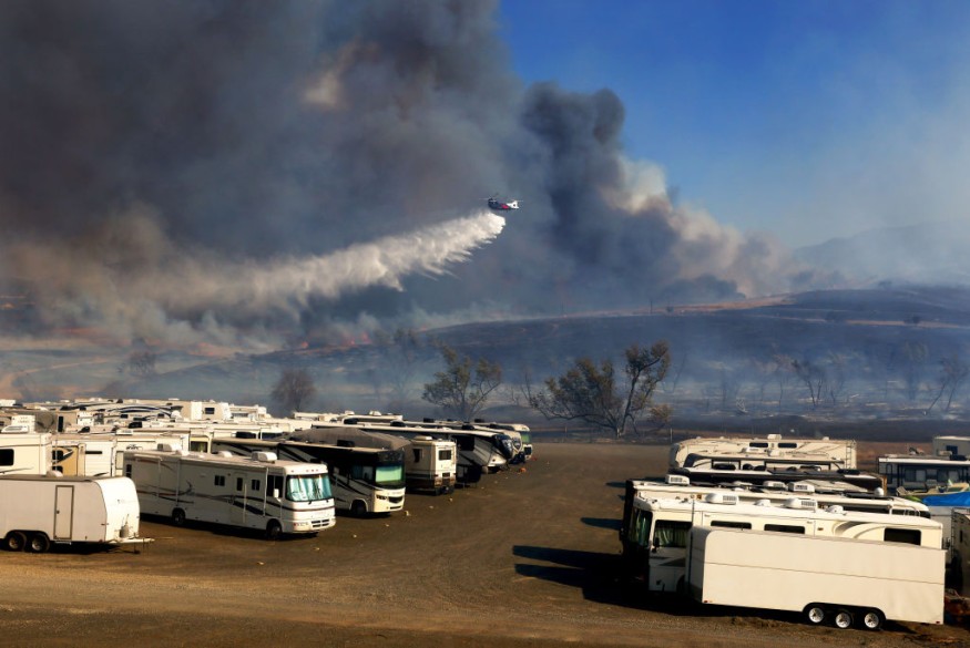
Last Wednesday, two firefighters were already injured in the fire, worsened by the fierce winds blowing in the Silverado Canyon in Orange County.
READ: Record High Deforestation Level in the Amazon Recorded in the Past 12 Years
Weather conditions to expect
The rest of the weekend saw local breezy conditions, but winds may earnestly pick up again late this Sunday in most parts of the state.
By Monday, Santa Ana winds are set to return, which may peak moderately from Monday night up to Tuesday, according to Dave Houk, a senior meteorologist of AccuWeather.
These gusty winds may return as a high-pressure system built in the Great Basin early this week, then funnel air from the Western interior going to the coast of Southern California.
This system's proximity to an expected off the area's coast may intensify the winds from the difference in the two systems' pressure. A large pressure discrepancy in a relatively limited geographical area is likely to produce strong winds. It is a means by which the atmosphere balances these forces out.
Meanwhile, in areas prone to winds, frequent gusts with speeds ranging from 40 to 60 mph will likely occur. Higher wind gusts may also funnel through passes and canyons, particularly those oriented to the southeast or northeast. A 90 mph speed can occur.
READ ALSO: Major Power Shutoff in California as Strong Winds Bring Fire Danger
Fanning the flames
These winds may cause already uncontrolled fires to spread even further. Any new erupting flames may also threaten to become raging infernos within just a few minutes.
High fire and wind gusts' threats may be serious enough in local areas to damage power lines and trees as well, especially in the passes and canyons wherein the winds are funneled as they travel towards the coast.
Toppled power lines can be additional sources of live sparks that could cause wildfires.
Preparations made
Last week, the wind event prompted utility companies in Southern California to cut the power of over 100,000 customers. Additional shutdowns could occur with this week's expected winds.
By the middle of the week, the winds have been forecast to slow down, although a new round of gusts could turn up later in the same week.
As preparation, CalFire advised locals last Friday to have updated Go Bags and emergency supply rations and kits ready. These could provide life-saving minutes should a sudden evacuation be necessary.
What to expect
Up to mid-December, no rainfall is expected in the region, particularly in Southern California. Thus, meteorologists warn of more danger of wildfire in Southern California, especially with high Santa Ana winds.
READ NEXT: Southern California Wildfire: Wildfire Rages, Tens of Thousands in Mandatory Evacuation
Check out for more news and information on Climate Change on Nature World News.
© 2026 NatureWorldNews.com All rights reserved. Do not reproduce without permission.


