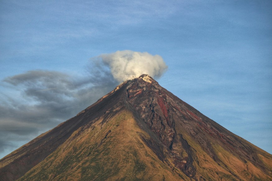
Mayon Volcano sent ash plumes soaring 1,000 meters from its summit crater on February 24, 2026, as PHIVOLCS cameras caught the action at 1:50 p.m. Grayish to brownish clouds drifted west-southwest during a busy 24 hours that logged 305 rockfalls, 20 pyroclastic density currents, and four volcanicearthquakes.
Unrest Builds Through February
Lava keeps flowing down Basud Gully, now 3.8 kilometers from the crater, while sulfur dioxide emissions spiked to 3,891 tons per day, per GMA News. This marks the fresh surge in activity putting Albay province on high alert.
The February 24 plume caps off weeks of escalating unrest, following a massive pyroclastic flow on February 9 that also hit 1,000 meters high. PHIVOLCS held Alert Level 3 steady since late 2025, locking down a 6-kilometer permanent danger zone to block sudden blasts, rockfalls, and heavy ashfall.
Barangays like Camalig and Guinobatan already see fine ash dusting roofs, fields, and roads, stirring health worries from poor air quality. Over 4,000 locals hunker down in evacuation centers, a direct response to the climbing risks.
Recent Activity Milestones:
- Alert Level 3 Raised: Late 2025 – Magma starts pushing upward.
- Major Pyroclastic Flow: Feb 9, 2026 – 1,000m plume with PDCs down flanks.
- Latest Ash Plume: Feb 24, 2026 – 305 rockfalls, lava advancing.
Eruption Forces and Monitoring
Deep magmatic intrusion pumps up the summit dome, which then collapses to unleash ash bursts and scorching flows toward nearby gullies. PHIVOLCS leans on seismic stations, gas sniffers, and RasPi cameras for nonstop surveillance, spotting night glow and slope bulging on the east side.
Authorities slam the door on danger zone visits, push masks for everyone outside, and map ash paths favoring southern winds. Farmers drape crops in plastic sheets, while aviation alerts reroute flights far from the hot zone.
Mayon Volcano's Fiery Legacy
This 2,463-meter Albay giant, with its postcard-perfect cone, tallies over 50 eruptions since 1616—many packing ash clouds, lava rivers, and mudflows that reshape valleys, as detailed by Britannica. The current rumble feels like 2018 all over again, when plumes climbed past 2,000 meters and cleared out thousands from harm's way, according to historical records on Wikipedia.
Tracking Fresh Mayon Volcano Alerts
PHIVOLCS daily bulletins keep tabs on gas spikes, quake patterns, and flow advances, dishing out sharp warnings to keep Albay one step ahead. With evacuation drills sharp and supplies stocked, residents brace smartly against whatever twists the unrest takes next—turning raw power into managed risk. Local leaders coordinate with relief agencies to distribute water, food, and medical kits, while schools shift to remote learning to shield students from ash hazards. Road clearings happen around the clock to maintain access for emergency vehicles, and community hotlines buzz with updates on safe zones. Tourists get steered clear through airport notices and hotel advisories, preserving the volcano's allure from afar. This layered response builds resilience, as families share stories of past cycles, blending caution with the unyielding spirit of Bicolanos facing their restless landmark.
© 2026 NatureWorldNews.com All rights reserved. Do not reproduce without permission.


