Light to moderate snow is expected in Southern California and the Southwestern US this late week, according to the National Weather Service (NWS). In Central Appalachians and Great Lakes, homeowners can anticipate the impact of lake-effect snow.
In San Diego, the forecast explained that increasing rain showers are likely, especially in the coastal areas and in the San Gabriel Mountains. Residents should stay alert for heavy rain and scattered thunderstorms on Friday.
In the Northern and Central High Plains, the latest advisory showed that temperatures can spike from 15 to 25 degrees above average this week. However, the chance of rain will be persistent in parts of California.
With the possibility of heavy snow, people should watch out for widespread travel disruption and weather risk this late week.
NWS Weather Forecast: Where Will Heavy Snow Unload?
According to the National Weather Service, the snowy outlook is likely in parts of the Northern Intermountain Region, Central Rockies and Cascades. People should check for freezing outlook and winter-related health concerns this late week.
In addition, higher elevation snow can unload in the Northwestern US. Recently, NWN reported the snowy outlook and road dangers in Colorado and Wyoming.
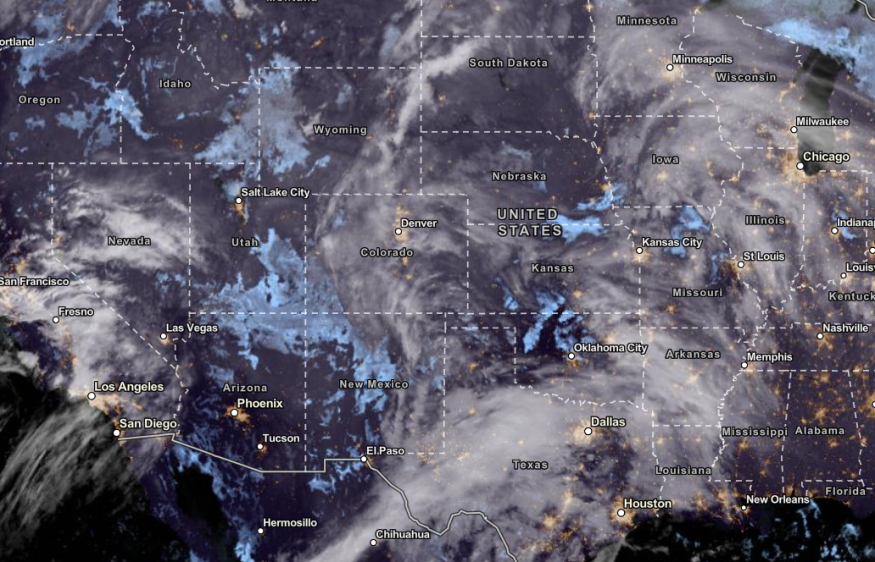
Americans traveling this late week should check the weather to avoid possible dangers. A good travel outlook is likely in parts of Seattle, Portland, Billings, San Francisco, Denver, El Paso, Minneapolis, Chicago and Houston.
Weather in the Plains and Southern US: What Can Residents Expect?
On the other hand, the forecast warned of challenging weather conditions in the Plains and Southern US as Christmas comes near. The weekend storm will likely unleash rounds of rain and flooding threats, particularly in flood-prone areas.
The rain potential will be beneficial for drought-affected areas in the Plains and Southern US. However, people with travel plans should keep away from flooded roads in the late week.
According to the latest forecast, the wet weather outlook is likely in Jackson, New Orleans, Houston, Dallas and Little Rock. The NWS weather advisory showed that light rain would develop in the Western Gulf Coast on Thursday evening.
The rain will spread in parts of the Great Lakes, Middle and Lower Mississippi Valley, including in the Central Gulf Coast on the weekend. On Christmas Day, light showers are possible in Minneapolis, Chicago, Kansas City, Memphis, Miami and Jacksonville.
Residents in the affected areas should keep updated with the forecasts in the Plains and Southern US to avoid travel dangers.
For more similar stories, don't forget to follow Nature World News
© 2026 NatureWorldNews.com All rights reserved. Do not reproduce without permission.


