The latest weather forecast showed that Southern California can expect the Santa Ana winds this early week, causing elevated fire risk in the region. The forecast warned of damage to small vehicles, trees, roofs and powerlines.
The National Weather Service (NWS) showed that a cold front in the Upper Great Lakes can cause light to moderate lake-effect snow, including in Lake Ontario.
In addition, moderate to heavy snow is likely in the High Plains and Southern Rockies this Thursday. Travelers should stay updated with the weather in the Rockies and California.
In the Lower Great Lakes and Northeast, a cold front and snow are expected in the early week.
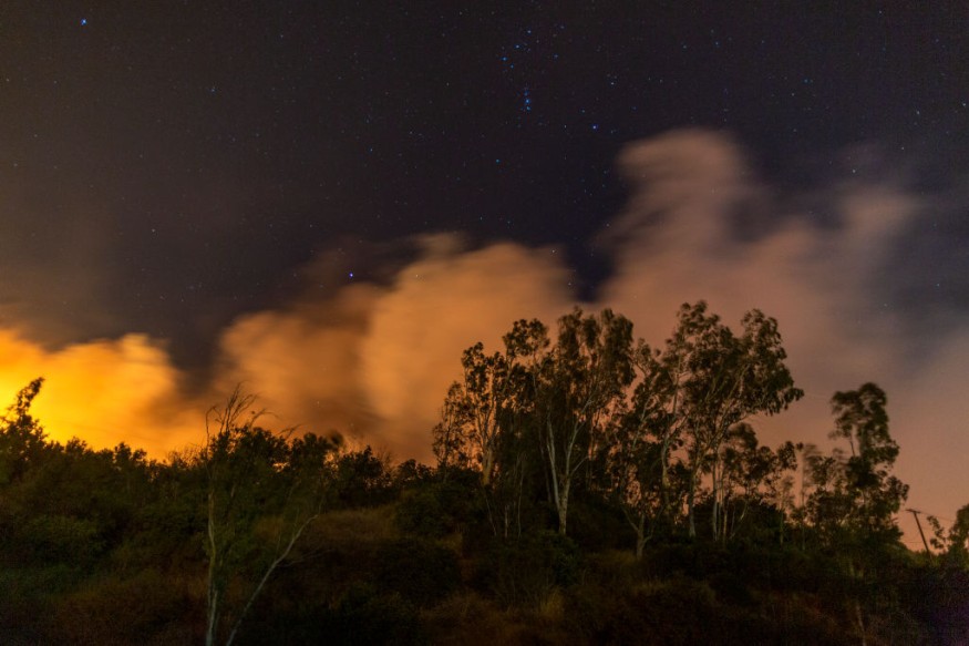
In Southern California, residents struggled for warmth and hot conditions. Raging wildfires were also reported in the region due to dry vegetation and low relative humidity.
Southern California Forecast: Where Will Strong Winds Unload?
In Los Angeles, Red Flag Warnings were reported in the LA and Ventura counties this week. The Santa Ana winds can reach from 30 to 50 mph. Homeowners should stay alert for fire concerns in the early week.
The strong winds and low relative humidity are favorable for raging wildfires in the region. Homeowners should observe local fire bans and avoid using flammable materials.
The latest forecast warned of increasing wildfire risks in Southern California due to the Santa Ana event. The beginning of December drought dry outlook in California.
Starting Tuesday, the wind gusts can reach from 30 to 40 mph, causing elevated fire risk in Santa Clarita, Oxnard, San Bernardino and Temecula. Car owners are advised to avoid parking in dry grass or vegetation.
Homeowners should also be careful in using flammable materials while in the forest or dry areas. Light vehicles are also at risk of strong winds. Motorists can experience driving difficulties, especially on interstates 5, 10 and 15.
Weather in Southern Plains and Central Plains
In addition, the NWS forecast showed that temperatures can drop from 15 to 25 degrees below average in the Southern and Central Plains. In Southern Florida, the forecast warned of thunderstorms and showers on Wednesday.
In Colorado and Northern Mexico, snowy outlook can reach from 6 to 12 inches. The colder temperatures can also lead to a wintry mix outlook in the US, including in the Upper Peninsula of Michigan.
In the Lakes Erie and Ontario, evening snow can be likely. Homeowners should limit outdoor activities.
Related Article : Tornado Cleanup in Tennessee: Colder Temperatures to Unfold This Week
For more similar stories, don't forget to follow Nature World News
© 2026 NatureWorldNews.com All rights reserved. Do not reproduce without permission.


