The latest weather forecast warned of severe weather conditions in the Midwest, Great Plains and Central US due to a powerful low pressure.
Americans with planned travel are advised to monitor the weather this week, especially in the affected areas.
Storms over Central KS and NE this afternoon will move eastward, eventually reaching NE Kansas and NW Missouri between 8-10pm. A few strong to severe storms are possible. Lower confidence in severe storms south of Hwy. 36. pic.twitter.com/hZKuhGHuZW
— NWS Kansas City (@NWSKansasCity) October 12, 2023
Due to the weather hazards, the main dangers this week are flooding rainfall, damaging winds, flooded roads and severe thunderstorms.
Powerful Low Pressure: Where Is It Expected?
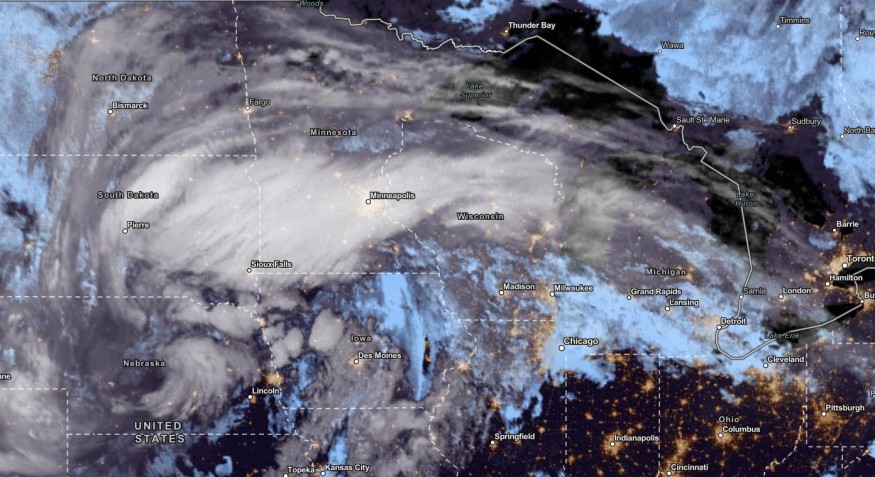
According to the National Weather Service (NWS), the large low-pressure system will bring severe weather conditions in the Central US, Midwest, Rockies and Great Plains.
The threat of thunderstorm conditions can be most likely in the late week, especially in the evening. Northwest Missouri, Northern Kansas, Eastern Nebraska and Western Iowa are at risk of poor weather conditions.
The latest forecast warned that the stormy conditions could reach the High Plains to the Atlantic Coast. Dry conditions in the North-Central US can also expect relief from drought.
In the Western US, the NWN report showed that a temperature drop could be likely.
However, residents should watch out for potential flooding rainfall. The snow could also unfold this late week in the Central High Plains.
On Saturday, the rain is expected to spread also in the Northeast. The following areas are at risk of the severe weather outlook:
- Green Bay
- Chicago
- Buffalo
- Boston
- New York
- Washington
- Raleigh
- Minneapolis
- Detroit
- Pittsburgh
- Philadelphia
- New York City
In New York City, the latest advisory showed that temperatures could reach lower to mid-60s with below-normal temperatures.
A rainy outlook is expected this weekend.
In a recent report, Southeastern US and Florida could experience thunderstorms and flooding this weekend.
On Friday, portions of the Midwest can expect poor weather conditions. In the late week, the areas at risk are the following:
- Rapid City
- Bismarck
- Fargo
- Minneapolis
- Sioux Falls
- Green Bay
- Peoria
- Indianapolis
Residents should watch out for slower commutes and other travel dangers. Motorists are advised to monitor the weather for potential flooded areas this weekend.
In Chicago, people are warned of potential widespread rainfall on Friday. Localized flooding concerns could unload in the late week. The forecast showed that the highest precipitation could unfold in the North of I-80.
Also Read: US Weather Forecast: Thunderstorms, Flooding Likely to Hit Southeast, Southern Alabama, Georgia
Weather Safety: How Americans Should Keep Safe
The poor weather outlook can cause travel dangers and severe flooding. The challenging weather outlook can put communities in flood-prone areas in the US at risk due to heavy precipitation.
Here are essential reminders to keep safe from the weather this weekend and until early next week.
- Homeowners should closely monitor the weather forecasts for flooded road conditions and damaging winds.
- It is best to evacuate immediately when the floodwaters become severe. People with travel plans should stay home when the weather causes heavy rains.
- Homeowners can keep emergency supplies, including medicines, radio, food supplies and rain jackets.
For more similar stories, don't forget to follow Nature World News.
© 2026 NatureWorldNews.com All rights reserved. Do not reproduce without permission.


