According to the weather forecast, a cross-country storm could bring rainy conditions and damaging winds in parts of the Northwest, Northeast, Plains and Rockies. Residents should remain alert for damaging winds and flooding rain.
There is also a chance to see a mixture of snow and rain in high-elevation areas in the Northwest. Motorists should watch out for travel dangers this week, including flooded roads.
Colder and unsettled weather is expected over the Pacific Northwest and northern California through mid-week. A surge of tropical moisture will bring an increased threat for heavy rain and flash flooding for portions of South Texas and the northern Gulf Coast Tuesday into… pic.twitter.com/BhUq47n8eP
— National Weather Service (@NWS) October 10, 2023
Weather agencies are also monitoring stormy developments. The weather outlook showed that Tropical Storm Max maintained a maximum sustained winds of 40 mph, bringing heavy rainfall to Southern Mexico's coast this Tuesday.
Meanwhile, Tropical Storm Lidia maintained maximum sustained winds of 79 mph. The forecast warned of Hurricane-force winds and flooding concerns in Central Mexico.
US Weather Forecast: Cross-Country Storm
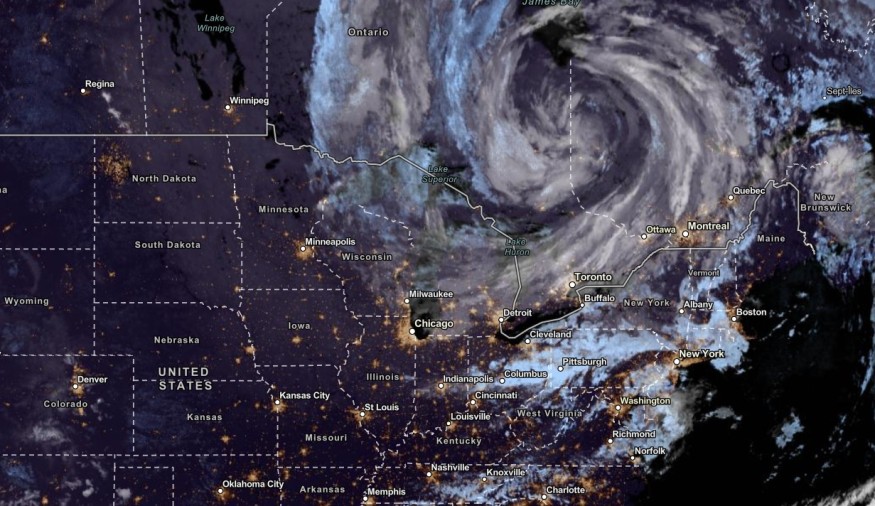
According to the latest forecast, a cross-country storm is expected to bring stormy conditions in parts of the Northwest, Western Plains, Northeast and Rockies.
This week's main threats are flooding rainfall, flash flood risks and damaging winds. Slower commutes and power outages can likely happen.
This is in addition to a pair of cold fronts in the Western US on Tuesday.
Residents can also expect the shift to a cooler pattern, with snow chances. In the midweek, potential thunder and rain can unload in the following areas:
- Seattle
- Spokane
- Casper
- Denver
- Helena
- Boise
- Wyoming
Homeowners with outdoor plans should bring a rain jacket and umbrella. Small flooding can occur in low-lying areas or with poor drainage systems.
From Wednesday to Thursday night, snow potential can unload in the following areas:
- Salt Lake City
- Casper
- Rapid City
- Scottsbluff
- Denver
The NWS advisory added that a low-moving close low aloft could bring cooler temperatures in parts of the Northeast and Great Lakes.
On Wednesday, the severe thunderstorms can develop. Damaging winds, hail and heavy rain can be possible.
The threat of severe thunderstorms can unfold in the following areas:
- Omaha
- Lincoln
- St. Joseph
- Kansas City
Furthermore, the poor weather conditions can stay until the end of the week.
In the Northern Gulf of Mexico and South of Texas, the forecast warned of a surge of tropical moisture and flash flood risks on Wednesday.
Meanwhile, rain conditions with possible thunderstorms can emerge in Charlotte, Nashville, Richmond, Louisville, Chicago, Detroit and Minneapolis.
Also Read : US Weather Forecast: Rain, Thunderstorms Likely to Hit Texas Gulf Coast, Great Lakes, Northeast
How to stay safe from severe weather outlook and flash flood risks
The recent forecasts warned of a dangerous weather outlook in parts of the US due to a developing cross-country storm. Here are vital weather reminders to remain safe this week.
Storing home emergency kits can help with emergencies during natural disasters. Homeowners should keep medicines, bottled water, canned goods, a small radio and a flashlight.
In addition, homeowners should urgently evacuate to safe areas when floodwaters worsen.
For more similar stories, don't forget to follow Nature World News.
© 2026 NatureWorldNews.com All rights reserved. Do not reproduce without permission.


