The beneficial rain is expected in the Central US this week due to a low-pressure area. According to the latest forecasts, thunderstorms and excessive rainfall could be likely this week.
Americans with travel plans should check the weather, as heavy rain could cause slower commutes and travel concerns.
Recently, the Central US experienced above-average temperatures, reaching from mid-80s and 90s on Wednesday. The relief from the heat could help with drought conditions and uncomfortable heat.
Central US Weather: Relief from the heat
According to the latest forecast, flooding downpours, challenging winds and hail conditions are likely on Friday. The affected areas are the following:
- Sioux Falls
- Omaha
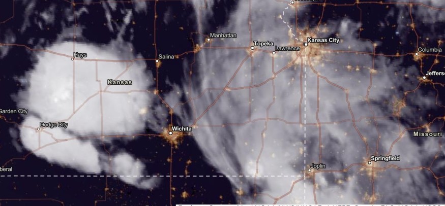
- Salina
- Kearney
- Kansas City
The low pressure and moisture from the Gulf of Mexico could help unload the region's heavy rain and thunderstorm conditions. On the weekend, severe thunderstorms are likely in Kansas, Oklahoma City, Omaha and Sioux Falls.
Oklahoma and North Texas could also experience large hail outlook and tornado threat, according to an advisory on September 19. Possible tornadoes could emerge as well.
On the weekend, the severe weather could continue in the following areas:
- Sioux Falls
- Omaha
- Des Moines
- Kansas City
- Springfield
The rain can benefit drought-stricken areas, but residents should stay alert for potential floodwaters or flooding due to excessive rainfall.
Weather in the Great Plains and Central Plains
On Tuesday night, scattered thunderstorms and flash flooding would impact parts of the Southern Great Plains.
Rain showers are likely in the Central Plains and parts of Kansas from Wednesday to Thursday. Meanwhile, Great Lakes can experience an above-average heat outlook.
Meanwhile, snow showers can unload in parts of Montana and Wyoming this week due to the colder air.
US East Coast weather outlook
In the US East Coast, the latest forecast reported a possible tropical system in the region, bringing a potentially severe weather outlook in midweek. The low-pressure area can help bring the rainy conditions, including in parts of Carolinas.
The tropical system could cause rough surf and rip currents on the weekend. Beachgoers should monitor the weather on the beaches.
Travel delays are also possible due to the heavy rain outlook this week. On Saturday and Sunday, rounds of rain could hit the following areas:
- New York
- Washingon
- Richmond
- Raleigh
- Charleston
- Portland
Also Read : Northestwern US Winter-Like Weather: Cooler Temperatures Likely This Week Due to Cold Storm System
Staying safe from flooding rainfall
The latest weather forecasts showed the flooding rainfall in parts of the country. Heavy rain could cause landslides, flash flooding and mudslides.
People must keep updated with the latest forecasts until the weekend. When the weather worsens, limiting outdoor activities is suggested.
Homeowners should also keep emergency supplies and weather kits, which include umbrellas, raincoat protection, medicine, food supplies, a small radio and flashlights.
Related Article : US Weather Forecast: Heavy Rain to Hit New England, Arizona, Central Wyoming, Colorado Early Week
For more similar stories, don't forget to follow Nature World News.
© 2026 NatureWorldNews.com All rights reserved. Do not reproduce without permission.


