Severe weather warnings have been issued by New Zealand's weather authorities this week, at least until Wednesday, April 19.
The warnings include heavy rain warnings and heavy rain watches in different parts of the country, particularly in the country's South Island.
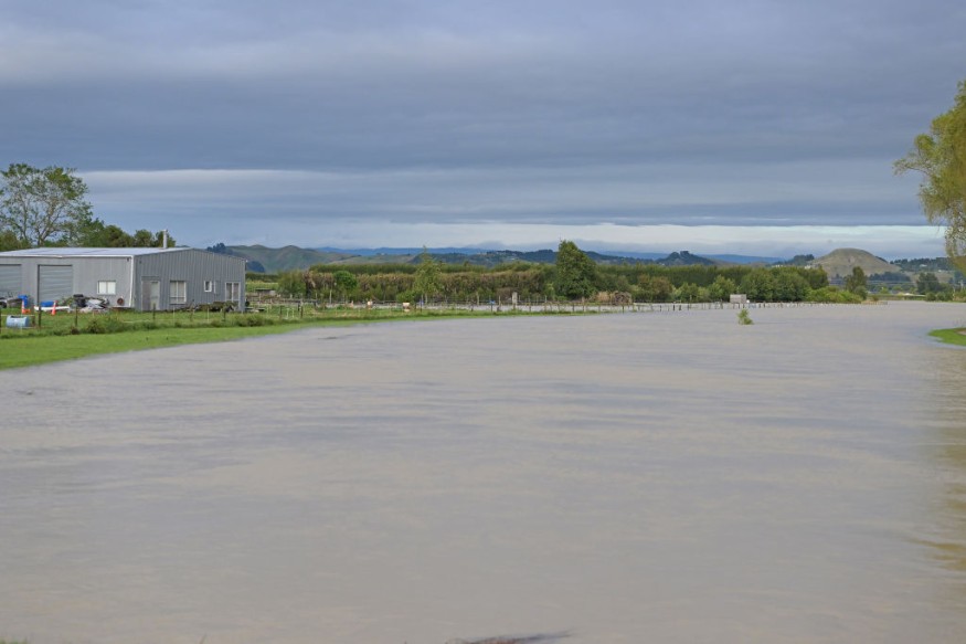
In the next hours or days, flash flooding due to torrential rain is possible in low-lying areas and communities near inland bodies of water.
New Zealand is currently in its autumn season that spans from March to May each year.
The said season is known for its "settled weather" compared in other periods of the year, with temperatures ranging from 7 to 21 degrees Celsius (45 to 70 degrees Fahrenheit), according to local tourism authorities.
Despite of having a track record of a pleasant weather, thunderstorms and wet conditions is still possible during the fall season.
New Zealand Severe Weather Warnings
New Zealand's Meteorological Service (Met Service) on Monday morning, April 17, issued severe weather warnings for a period of heavy rain for the western and northern parts of the country's South Island.
It warned a front is expected to move from the west from Tuesday to early Wednesday, April 18 to April 19.
The front is reportedly preceded by a strong and moist northerly flow, which is then followed by a change to southwesterlies.
Heavy rain warnings and heavy rain watches are in effect in affected areas of western-northern South Island.
Met Service are advising the public to monitor local weather developments and keep up-to-date with the latest weather forecast, which can change at any time.
Heavy Rain Warnings and Watches
As mentioned earlier, the Met Service issued heavy rain warnings in multiple locations across South Island.
One of these locations is the Tasman west of Motueka area, where the warning will take effect for 12 hours from 3:00 p.m. on Tuesday to 3:00 a.m. local time on Wednesday.
Here, the New Zealand weather agency forecast 80 to 110 millimeters of rain in the ranges and 50 to 80 millimeters near the coast.
Peak rainfall of 15 to 25 millimeters per hour are anticipated starting in the late hours of Tuesday evening.
Meanwhile, the areas of Westland from Otira southwards are also under the heavy rain warnings, which will span for 15 hours from 3:00 a.m. to 6:00 p.m. on Tuesday.
During this period, 80 to 110 millimeters of rain, with peak rates reaching 15 to 25 millimeters per hour is expected.
Furthermore, the weather service issued heavy rain watches for the following areas:
- Richmond and Bryant ranges
- Buller and Westland, located north of Otira ranges
- Canterbury lakes and rivers, located south of Arthur's Pass
- Fiordland
The weather advisory level 'watches' pertain to the potential occurrence of moderate to heavy rain in a particular area.
New Zealand Deadly Flooding
Earlier this year, New Zealand experienced deadly flooding due to heavy rain, which killed at least four people and forced hundreds to evacuated in Auckland back in January, CNN reported.
About 66% of New Zealand's population lives in areas that are vulnerable to flooding, especially those near the coast, where floods will be aggravated by rising sea levels and storm surges, according to the organization Royal Society of New Zealand.
© 2026 NatureWorldNews.com All rights reserved. Do not reproduce without permission.


