Weather systems are lingering over several regions in the United States in recent days.
While the Gulf Coast system is weakening over the South US, an atmospheric river is set to hit the Pacific Northwest and a Gulf of Alaska storm could affect the 49th state, according to US weather authorities.
During this period, flooding due to heavy rainfall and cooler temperatures are possible for the upcoming week.
NWS Weather Forecast
The National Weather Service (NWS) - Weather Prediction Center (WPC) at 3:56 p.m. EDT (local time) on Sunday, October 30, issued a short-term forecast for the said weather systems.
The forecast is valid from Monday to Wednesday, October 31 to November 2.
In the Gulf Coast, rain showers and thunderstorms are possible in some areas across the Deep South and Mid-South in spite of the weakening weather system that moves over the region.
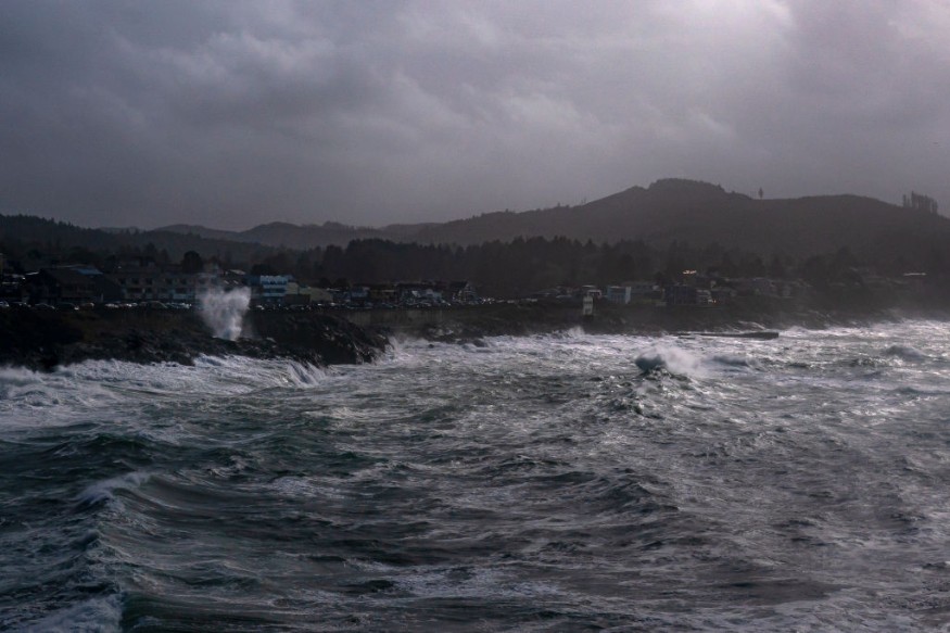
In the Pacific Northwest, localized heavy rain and mountain snow will continue due to an approaching weather system.
In Alaska, coastal areas are at risk due to a brewing storm off the coast.
Gulf Coast Weather System
The Gulf Coast will see a separate low pressure system south of the US, causing scattered showers and thunderstorms into South Texas and parts of west-central Texas from Monday to Tuesday, there is a chance precipitation will decrease in Texas by Wednesday.
The weakening of the Gulf Coast system follows the occurrence of a thunderstorms over the region.
ABC News reported that at least five tornadoes occurred during a tornado outbreak on Saturday, July 29, along the Mississippi and Alabama Gulf Coast.
There were no reported deaths during the during the initial report on Saturday.
The NWS stated that three tornadoes hit Jackson County, Mississippi, each with maximum sustained winds approximately between 100 miles per hour (160 and 175 kilometers per hour).
In Alabama, two weak tornadoes struck the state with winds of 72 mph (115 kph) or less were confirmed; one occurred in Theodore and one south of the downtown area of Mobile.
Pacific Northwest Atmospheric River
Previous forecasts by US meteorologists support the prediction that a "storm train" will persist over the Northwest, causing rainy weather and cold temperatures in the Pacific Northwest of the US until November, according to MSN.com.
This weather outlook was also covered by Nature World News.
The stormy weather phenomenon brought torrential rain and high-elevation snow over the region, which will experience renewed similar weather events due to the approaching atmospheric river.
The National Oceanic and Atmospheric Administration (NOAA) stated atmospheric rivers are relatively long, narrow regions situated in the Earth's atmosphere, where it resembles "rovers in the sky" that transport most of the water vapor in the clouds outside the tropics.
In addition, vapor column carried by the floating river moves along with the weather.
The atmospheric river releases this vapor or precipitation in the form of either rain or snow.
© 2026 NatureWorldNews.com All rights reserved. Do not reproduce without permission.


