Wet weather and cooler temperatures will continue to impact the Pacific Northwest of the United States until November, according to meteorologists.
The weather events are fueled by a so-called "storm train," which has been hovering over the region for several days already, halting the unusually warm and dry onset of the fall season.
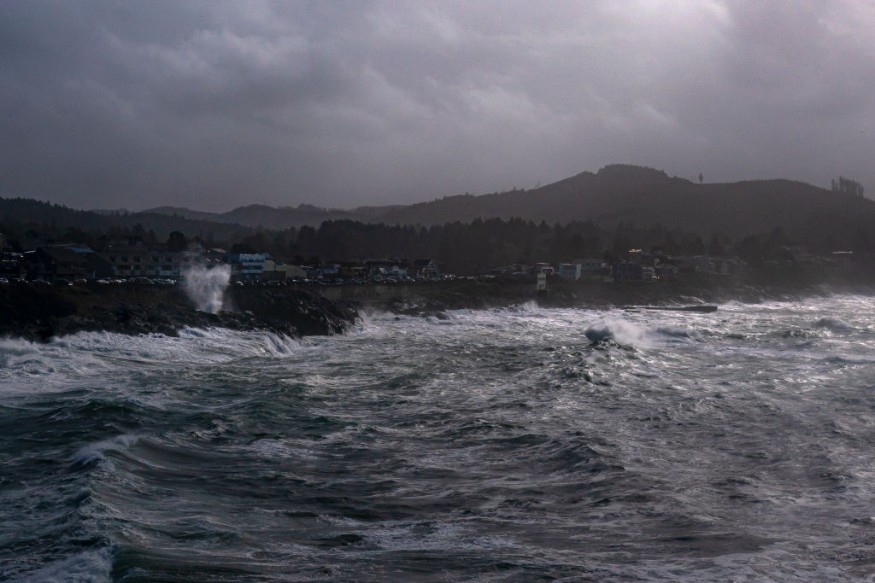
In the coming days, there is a risk of flooding in the coming days and weeks.
The weather train is the same as the storm systems affecting the region earlier this week, based on previous forecasts by the National Weather Service (NWS) and was also covered by Nature World News on Wednesday, October 26.
Initial weather reports stated that the rainfall associated with the storm will bring beneficial rain, especially in the drought and wildfire-stricken regions of the American West.
The weather forecast comes out after the system cleared the smoky skies of Seattle, Washington, only in a span of several hours.
The rainy weather and cold temperatures over the Northwest is also expected to affect surrounding regions, including the Rocky Mountains.
In reiteration, the inclement weather is also expected to bring relief to river networks feeding the Mississippi River further in the Eastern US.
The forecast also follows a recent NWS report last week of a major weather pattern change affecting the Northwest and Western US as a whole, bringing inclement weather conditions and below-average temperatures.
Such change is expected as the country is already halfway in its journey of the fall season and ahead of the winter season in December, when temperatures are anticipated to further plummet.
Pacific Northwest Storm Train
AccuWeather meteorologists said the storm train will allow the persistence of the ongoing wet and cool pattern, wherein over the past week have brought downpours and mountain snow.
In the upcoming weekend, the meteorologists project more is to come since a significant storm system from the Pacific Ocean will crash into shore.
The prevailing storm system first arrived in the Pacific Northwest last Friday, October 21.
The rainfall it brought across the region is the first instance since July and also the first significant snow of the season in the Rockies, a region bombarded by wildfires and drought conditions, according to CNN.
Also Read: Major Weather Pattern Change Possible Across the Pacific Northwest and Western United States [NWS]
Western Drought
The said precipitation is reportedly needed in most parts of the West due to some level of drought, according to the US weather forecasting company.
The AccuWeather forecast is in line with the recent report of the U.S. Drought Monitor (USDM) that all of the state of Washington and over 99% of Oregon are experiencing the brunt of "abnormally dry conditions."
Back in July, the Economic Research Service (ERS) of the U.S. Department of Agriculture (USDA) cited USDM's report that more than 32% of land in the Western US was determined to be experiencing extreme or exceptional drought.
The USDM report was based on data of past droughts since the year 2000.
© 2026 NatureWorldNews.com All rights reserved. Do not reproduce without permission.


