Storm systems are bringing the much-needed rainfall to the Pacific Northwest and clearing its smoky skies for the first time since July.
This comes as a weather system in a form of a cold front traveled into the Southern United States, bringing severe thunderstorms.
Meanwhile, significant snowfall also occurred in the Western US, where some parts had suffered from prolonged drought and dry conditions.
The storm reached the Northwest last week, as well as in the Rock Mountains, a region that needed precipitation to address the active wildfires and drought conditions.
US meteorologists forecasted the continuance of rain showers and relatively cooler temperatures in the West this week.
During this period, there is still a potential for flooding and disruption to travel, as well as to power utility.
There were instances of fluctuating weather patterns and temperatures in Northwest over the recent months, ranging from hot, moderate, to cooler temperatures.
However, its surrounding regions such as the Southwest US were largely under fire weather conditions that supported the growth and spread of wildfires.
This phenomenon is the case especially during the recent summer season.
Storm Systems
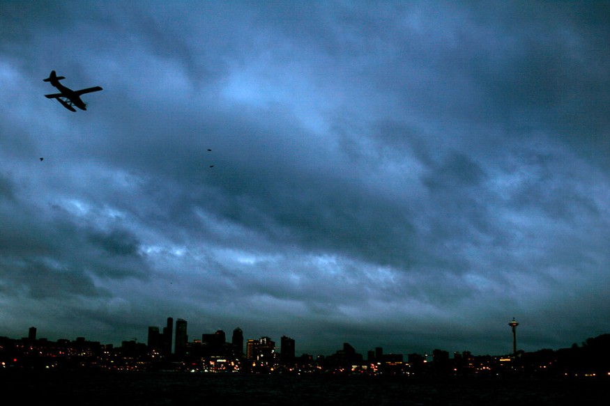
CNN meteorologists reported the storm system arrived onshore the Pacific Northwest last Friday, October 21, causing the downpour of rain and even clearing out Seattle's smoky skies in just a matter of hours.
The storm will also bring rain east of the Rockies and bring relief on the wide network of rivers that feed the Mississippi River, which has reached its lowest water levels.
Citing the National Weather Service (NWS) and the Storm Prediction Center (SPC), the meteorologists also forecasted the occurrence of the thunderstorms in the South US, where a recent tornado struck the town of Jarrell, Texas.
Fall-Like Weather
A so-called "fall-like weather" arrived last Friday afternoon and also brought strong winds.
A resident by the name of Jeff Anderson was glad the rain finally arrived to put out the wildfires across the region, clear the smoke in the air, and cool down the temperatures, as cited by local news outlet Fox 12 Oregon.
In addition to Seattle, Anderson said the rain in recent days cleaned up the smoky air that gripped most parts of the Pacific Northwest last week. With the return of rain, the Oregon Department of Forestry announced the end of its fire season.
Drought-Stricken Region
Prior to the arrival of the system, there a was a reported continuance of an extended fire season in the region, paving the way for the ignition of wildfires due to dry, warm, and windy conditions.
Currently, the emergence of an inclement weather could finally put an end to the extreme weather events associated with heat waves and hot weather.
Last week, the National Environmental Satellite, Data, and Information Service (NESDIS) reported wildfire eruptions in the Pacific Northwest due to dry weather conditions for the month of October.
Some of the major wildfires include the Bolt Creek Fire, Loch Katrine Fire, 8 Road Fire, Goat Rocks Fire, and the Nakia Creek Fire, NESDIS adds.
While the beneficial rain could address the drought conditions faced by the Western US, it is unclear if it could totally extinguish the ongoing wildfires.
Related Article : Atmospheric River Rages Towards the Pacific Northwest
© 2026 NatureWorldNews.com All rights reserved. Do not reproduce without permission.


