Weather stations are monitoring the potential development of storms in the coming week after Hurricane Ian slammed Florida.
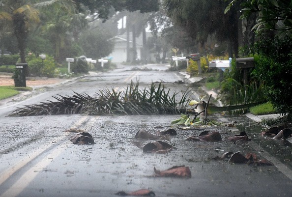
The impact of Hurricane Ian was immense, resulting in a massive power outage, flooding, and damage. In recent news from Reuters, on October 3, 2022, Hurricane Ian resulted in over 80 dead. Search and rescue operations for affected communities have been continuing.
The National Hurricane Center's latest weather advisory, published on October 2, 2022, reported that the Hurricane Center was monitoring two systems.
- It added that the tropical system in the westernmost system might be a tropical depression in a few days.
- On the other hand, the report said the easternmost system could become a depression by midweek.
The next storms that will emerge in the Atlantic will be named Julia and Karl.
Also Read: Coastal Storms Could Bring Flooding and Windswept rainfall to Southeastern Virginia and Long Island
Eastern Tropical Atlantic
Moreover, the National Hurricane Center noted that the Eastern Tropical Atlantic was located several hundred miles south of Carlo Verde Islands. Reports showed that the developing storm might unleash disorganized rainfall showers and thunderstorms, noting that the formation chance of the storm is high in five days.
In Hurricane Center's monitoring, the advisory said a tropical depression could likely form in the middle of the week.
Meanwhile, forecasts said that the tropical system was moving westward, and then it will turn northwestward or northward by the week's end on the eastern tropical Atlantic.
On the AccuWeather weather update on October 3, 2022, Senior Meteorologist Dan Pydynowski said that the tropical wave of Cabo Verde Island had a high chance of developing into an organized tropical system.
The weather report said that the storm might bring winds and rains this week to the westernmost islands, which is expected not to create a major impact.
East of the Windward Islands
A recent advisory showed that a tropical wave was located about several hundred miles east of Windward Island and expected to reach the islands and the eastern Caribbean Sea by midweek.
The National Hurricane Center has been monitoring the potential development of a tropical depression in the next few days, moving westward at 15 to 20 mph.
Storm tips
As two tropical systems are still undermonitoring, there could be a possibility that they might develop into tropical storms. Whether they would strengthen or dissipate, it is essential to be prepared, especially in the affected communities with hurricane or flood watch warnings. Here are some safety reminders.
- Weather stations emphasized staying updated with the storm's impact and storm warnings.
- Storms and hurricanes can cause stronger winds and rainfall flooding. Prepare your home and family by checking your house for possible damage from the previous storm. Immediately repair all the cracks.
- Prepare emergency lights, power banks, and food supplies. The impact of the storm can turn down the power and communications lines.
- Especially in coastal areas, evacuate as advised by local authorities or when the sea water level rapidly rises.
On the other hand, reports revealed that coastal storms in Virginia and Long Island could bring flooding and rainfall, with flooding reminders in affected areas in New Jersey, Chesapeake Bay, Virginia Tidewater, southern and the eastern Delmarva Peninsula, and Albemarle and Pamlico.
For more similar stories, don't forget to follow Nature World News.
© 2026 NatureWorldNews.com All rights reserved. Do not reproduce without permission.


