A monster storm warning was issued by meteorologists for Australia as heavy rainfall is expected next week.
A colossal storm hovering over the country is responsible for the potential extreme weather event, marked by severe thunderstorms, gusty winds, and flooding due to heavy rain.
Monster Storm Warning
Meteorologists from Australia's Nationwide News on Thursday, September 29, said that Aussies are warned to brace for heavy rain next week despite forecasts that the storm is easing.
This comes as wild weather rocked impacted southeastern Queensland and most parts of New South Wales earlier this week.
Life-threatening storms, hail, and rainfall are possible, causing property damage and disruption.
On Wednesday evening, September 28, dangerous storms lashed out in the Wollongong region as torrential rain brought totals of between 70 and 80 millimeters.
However, the risk will ease for most parts of the Eastern Australia coast at least this weekend.
The Australian media company provided the weather conditions in the following states, citing as well different outlook from other news outlets.
Also Read : Tropical Cyclone Warning: Meteorologists Predict a Storm Could Develop Off the Coast of Queensland Next Week
Australia Weather Forecast
Approximately 90% of Australia will experience localized or widespread rainfall in the next 10 days.
This forecast is due to a low pressure that brings severe thunderstorms, heavy downpour, and hail, according to Sky News Australia.
Sky News Meteorologist Allison Osborne explained that the same weather system has been causing southwesterly air stream over the New South Wales coast and into eastern Victoria state, as cited by Nationwide News.
Storms are likely to navigate toward the northern New South Wales coast and linger on Sunday, October 2.
This means that inclement weather will persist for the eastern states into the weekend in spite of reports that the severe storms will ease.
However, this is expected to change by next Wednesday, October 5, when a massive low pressure system moves to the east carrying a gargantuan amount of precipitation.
The system will then drag showers over the eastern region from Queensland down to the state of South Australia and will intensify on Thursday, October 6.
Unprecedented Wet Weather
Osborne predicted a colossal amount of rainfall will transpire over a two-day period over "catchments" that were already subjected to recent flooding.
Widespread rain totals across the eastern states could reportedly exceed 100 to 150 mm.
Similar weather conditions have been forecasted not only in Queensland and New South Wales, but also to the states of Western Australia, Victoria, South Australia, Tasmania, and Northern Territory.
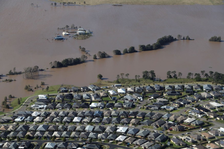
Severe weather could impact the mentioned areas and cause flash flooding risk in low-lying areas and communities near mountain slopes due to runoff caused by torrential rain.
Australia's Bureau of Meteorology on Tuesday, September 27, reported the continuance of major flooding for most parts of inland New South Wales, as well as flood watches placed for Victoria.
Over the course until next week, the persistent rain could lead to riverine flooding as well since inland bodies of water like lakes, streams, and rivers could also overflow.
© 2026 NatureWorldNews.com All rights reserved. Do not reproduce without permission.


