Through Sunday, thunderstorms will move over the center of the US. Although the intense weather storm may prevent outdoor activities across the Central states through Sunday, farmers will appreciate the rain.
Mixed Reception
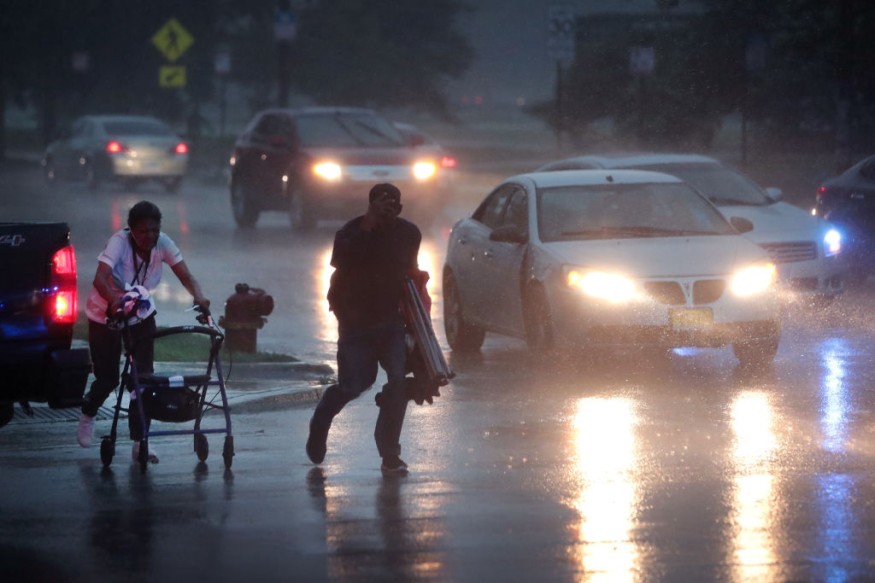
While some outdoor enthusiasts' plans may be derailed by the possibility of thunderstorms from the Plains to the Midwest through Sunday, farmers throughout America's corn and soybean belt should celebrate as Mother Nature continues to provide the essentials for a successful crop. Forecasters caution that gusty gusts, frequent lightning, and sporadic localized flash floods are possible with the rain.
The central and northern Plains have recently seen hot weather, with highs in the Dakotas and Nebraska reaching well into the 90s F. The century milestone has frequently been surpassed further south.
On Saturday, the northern Plains had widespread cloud cover and typically light showers and thunderstorms, which helped temper the heat.
Entering the US
On Saturday night, these thunderstorms should move south and east. This should cover a large portion of northern and central Kansas and Missouri and other places that have recently been somewhat dry.
Overnight travelers, especially those in flashy cars, should be on the lookout for thunderstorms that might cause strong winds and pounding on the interstates 35 in northern Missouri and 70 between Missouri and Kansas.
Overnight Saturday and into Sunday morning, more precipitation is predicted to be added to the thunderstorm activity over the Midwest, raising the possibility of flash floods. This risk extends throughout much of central Illinois as far as Kirksville and St. Louis, Missouri.
Making Landfall
On Sunday during the day, the Ohio Valley is forecast to have significantly more favorable atmospheric conditions for drenching thunderstorms. The area's millions of acres of agriculture will primarily benefit from this, even if there will still be a small risk of a few severe wind gusts.
Some sizable cities could be located in the Midwest region's area of potentially heavy rain on Sunday. Detroit, Cincinnati, Indianapolis, and perhaps Columbus and Columbus might participate in some of the action. The inclement weather may impact several vital highways, including Interstates 65, 69, 70, 75, and 80. Drivers are in danger because ponding on road shoulders can cause fleeting episodes of hydroplaning.
While rain over the weekend is never ideal, areas of the Plains and Midwest may have their last shot for some time since a dome of high pressure is predicted to bring a prolonged period of dry and hot weather to the area next week.
Staying Safe
Massive hurricane-caliber storm systems regularly migrate closer to land after originating over ocean water. Tornadoes, floods, storm surge (an increase in water level), strong winds, and heavy rain are all brought on by hurricanes. These storms are hazardous and may cause damage to far-inland places. Be prepared as soon as you can so that you can stay safe.
Develop a safety plan. Determine what will give you the most protection from flooding and severe winds. Plan properly for both your safe haven and your escape. Gather the materials and knowledge you'll need when the storm strikes by spending some time now.
If you are told to evacuate, do so right away and get somewhere safe.
Related Article : Exposure to Major Disasters Can Cause Long-Term Mental Health Problems
For more climate and weather updates, don't forget to follow Nature World News!
© 2026 NatureWorldNews.com All rights reserved. Do not reproduce without permission.


