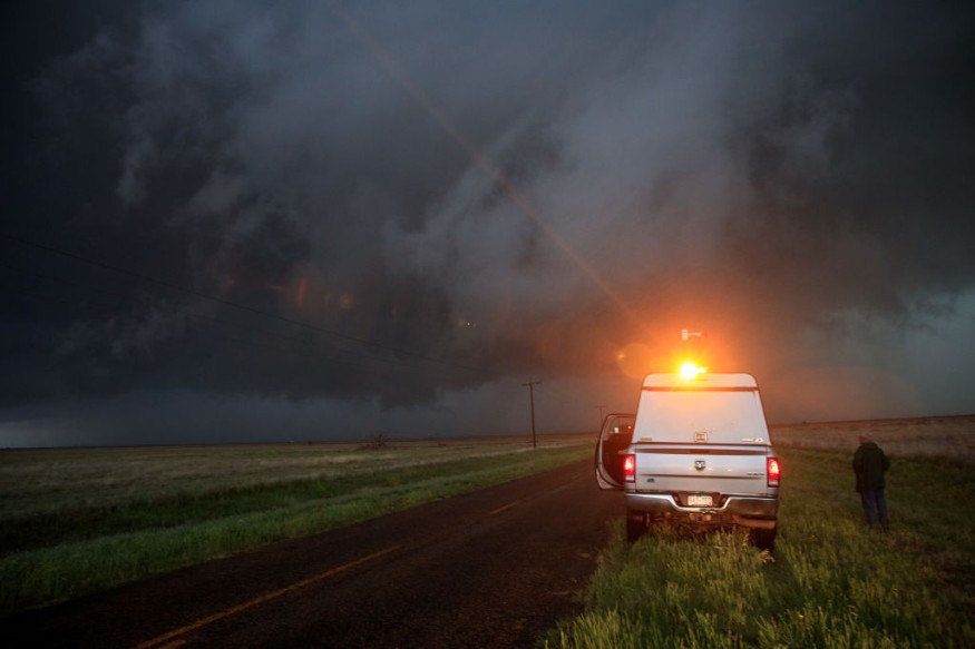
Parts of the High Plains have had several locally devastating thunderstorms this summer, and AccuWeather meteorologists predict that a further increased danger of severe weather will continue through Friday night.
Heat Dome
A heat dome has covered the southern Plains for the past few weeks. Thunderstorms are frequently produced by this heat dome's movement of energy in the atmosphere, as are occasionally persistent groups of storms.
According to AccuWeather Senior Meteorologist Mike LeSeney, violent thunderstorms with strong winds will develop around the northern edge of the heat.
Storm Development
According to AccuWeather Meteorologist Adam Sadvary, "the strongest of the storms may be able to create hail and downpours due to the abundance of energy in the sky, but the largest hazard will be severe wind gusts."
Thunderstorms started to form in the middle of the day after a calm morning. The storms are expected to get stronger throughout Friday's late afternoon and evening as they move over Montana on their way east.
Also Read : Dozens Missing as Flooding Drowns Virginia
Wind Generation
With wind gusts that might reach as high as an AccuWeather Local StormMaxTM of 90 mph during the late-week storms, the damaging wind is the primary safety issue. High-profile cars traveling on area highways may be at risk from winds this strong.
In Wyoming and Saskatchewan, further storms are expected to form farther to the south. Although coverage might be less extensive, comparable risks are anticipated from all storms.
Although storms often decrease after sunset, the storms on Friday may continue long into the night as they move into the western section of the Dakotas, but they will probably lose some of their strength as they go through these states.
Weather Disturbance All Over the Northern Plains
On Saturday, the same disturbance that caused severe weather on Friday night will move eastward, affecting portions of Montana, Wyoming, and the western half of the Dakotas. The storms will intensify once again as the day gets warmer.
Storms with strong gusts and hail are expected to threaten areas from eastern North Dakota to central South Dakota.
Further east, severe weather is not expected to affect the Midwest this weekend, while thunderstorms may be locally gusty and wet.
Also Read: Hurricane Darby Causing Trouble Across the Eastern Pacific
Storm Preparedness
Huge storm systems identified as hurricanes frequently make their move toward land after developing over ocean water. Hurricanes bring tornadoes, floods, storm surge (an increase in water level), powerful winds, and heavy rain. These storms may harm areas far inland and are dangerous. So that you may remain secure, be ready as quickly as possible.
Survival Plan
Create a safety strategy. Identify the greatest protection for you from flooding and strong winds. Plan your escape and your safe haven accordingly. Spend some time right now gathering the resources and information you'll need when the storm hits.
If urged to leave, do so immediately and get to a secure location.
Related Article: Exposure to Major Disasters Can Cause Long-Term Mental Health Problems
For more climate and weather updates, don't forget to follow Nature World News!
© 2026 NatureWorldNews.com All rights reserved. Do not reproduce without permission.


