Australian national authorities have announced a global catastrophe after areas in the nation's military east get almost a year's supply of precipitation in only just couple nights.
Australian City Experiences Extreme Downpours
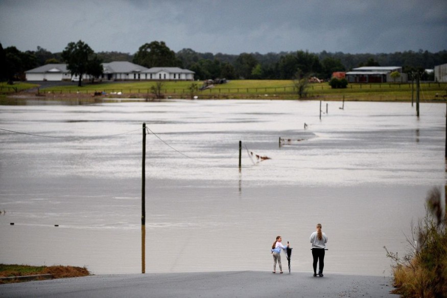
Roadways in prominent metro areas as well as the wider countryside have transformed into streams, and AccuWeather climatologists caution that far more precipitation is on the line.
As per Reuters, approximately 50,000 inhabitants in the territory of New South Wales, that includes Sydney and has a population of 8.1 million people, were ordered to vacate owing to fast approaching high tides.
The Australian Administration's Bureau of Meteorology (BoM) stated that 12 inches (298 mm) of torrential rain in only 24 hours, beating the previous for the maximum cumulative precipitation average for July at those meteorological stations in Darkes Forest, New South Wales, over 126 years of monitoring.
On July 6, 1973, at Mount Moombil, some 380 miles (600 km) from Sydney, the greatest measured precipitation in 24 hours in Australia was 22 inches (554 mm).
With far more than three decades of records, the Campbelltown gauge achieved its greatest known daily cumulative precipitation quantity for any period. Six gauges with over 100 years of monitoring established a milestone four-day aggregate for July.
Precipitation tallies for the whole week have reached approximately 28 inches (700 mm) slightly south of Sydney in Wollongong, prompting water sources in the area to become fully inundated.
While AccuWeather Senior Meteorologist Jason Nicholls claimed that the metropolis of Sydney experienced roughly 20 times it's typical July downpour in only four days. Supplemental, although weaker, precipitation is forecast to persist in the vicinity until Wednesday, escalating the inundation situation.
Nearly a Year Worth of Rain in Populated Areas of Austrialia
This disaster was very sluggish, forming off the eastern peninsula of New South Wales, where ocean level conditions are well beyond normal at this period of season, providing the event with additional intensity and humidity.
Early Monday morning, a vessel departing the harbor of Wollongong lost steam and was greeted by massive seas with swells rising 26 feet (8 meters) and gusts roaring at 34 mph (55 km/h).
As of Tuesday, zero fatalities had been evaluated as a result of this big meteorological phenomenon, although precipitation is forecast to persist until Wednesday, causing bodies of water including such Wollombi Brook, Macquarie River, and Tuggerah Lake to overflow and reservoirs to fill up, The Associated Press reported.
This previous weekend, massive rains saturated the territory between Sydney and Wollongong, Australia, shattering numerous of benchmarks. The propeller split while attempting to pull the vessel back to the harbor, forcing the emergency mission to be canceled up because to severe seas and weather, according to The Associated Press.
An East Coast Low is the powerful downpour that brought the unprecedented precipitation and consequent floods. Not merely were places swamped with flooding, yet extreme climate advisories for destructive gale force winds and dangerous surf were announced for New South Wales on Monday.
Related article : Strong Rain Expected to Hit Parts of China because of Typhoon Chaba
© 2026 NatureWorldNews.com All rights reserved. Do not reproduce without permission.


