Storms are brewing over New Zealand as the country continues to prepare for a potential catastrophic weather event.
New Zealand's Met Service has issued dozens of severe storm warnings nationwide. More than 18,000 lightning strikes were recorded across the country over the weekend.
In addition to lightning, the severe weather could also bring damaging winds, tornadoes, winter storms, snow, and large hail.
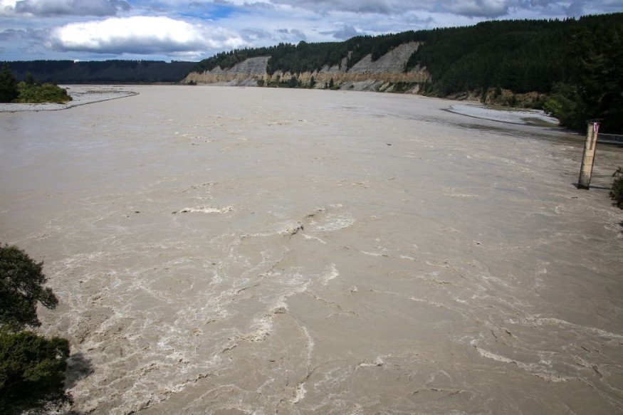
Heavy rain is possible in low-lying areas or those near the coast, as well as communities near rivers and lakes.
Meteorologists reportedly consider the current weather conditions of such magnitude to be rare.
The Met Service provided its weather forecast that severe thunderstorms will continue in the coming days and even possibly before the weekend.
New Zealand storms are relatively rare and most emanate from tropical cyclones from the Pacific Ocean and across the waters of the Oceania continent.
Other source of these inclement weather in the so-called "Aotearoa" country were from weather disturbances like a low-pressure area or a storm system.
New Zealand is currently in its winter season which spans from June to August.
The climatic season is somehow similar to Australia, which experienced a recent Antarctic blast of cold air and winter storms since the beginning of the month.
Severe Weather Warnings
The Met Service has placed a total of 42 severe thunderstorm warnings and severe thunderstorm watches across New Zealand, where 19 placed in the North Island and 23 in the South Island.
Weather forecasters warned the start of the week could be potentially damaging, as cited by Stuff.co.nz.
The short-range weather outlook comes after the weather agency recorded 18,039 lightning strikes in the past 12 hours as of 9:30 a.m. local time on Sunday, June12.
Majority of the lightning struck over water, with 1,119 cloud to ground strikes reported over the North Island and 256 in the South Island.
There were no immediate reports of casualties.
However, the agency said widespread disruption and destruction is possible this week, highlighting that the adverse weather is caused by a slow-moving tropical low which could remain in New Zealand longer.
Storm Affected Areas
The Met Service also issued the following storm-related warnings and the specific areas affected from Monday, June 13.
Severe Thunderstorm Warnings:
- Nelson
- Buller
- Westland
- Canterbury High Country
- Waikato
- Waitomo Taranaki
- Wanganui
- Manawatu
- Tararua
- Kapiti-Horowhenua
- Wairarapa
Severe Weather Warnings:
- The Tararua Range
- The Tararua District
- Hawke's Bay
- Marlborough
Road Snowfall Warnings:
- Desert Road
- Lewis Pass
- Arthur's Pass
- Crown Range Road
- Milford Road
The organization also imposed "Heavy Swell Warnings" or strong waves for coastal areas from Kapiti-Porirua Coast - Otaki to Cape Terawhiti.
A "Heavy Rain Watch" and "Strong Wind Watch" were also issued in multiple areas countrywide.
Tornadoes and Flooding
In the latest weather updates, at least two tornadoes struck Waikanae in the Kaiti Coast, according to 1 News.
Furthermore, New Zealanders took to social media to post about major flooding that has already occurred, with pictures of damaged roof, uprooted trees, and among others, according to The Canberra Times.
Over the past week, The Canberra Times reported more than 100,000 lightning strikes occurred across New Zealand amid the severe weather.
© 2026 NatureWorldNews.com All rights reserved. Do not reproduce without permission.


