Flood threat due to rising river water level is causing an alarm for three communities in northwestern British Columbia, Canada, as of Monday, June 6.
Local authorities have issued mandatory evacuation orders along with a flood watch and local state of emergency in the affected areas to warn residents and avoid being trapped in case of potential overland flooding.
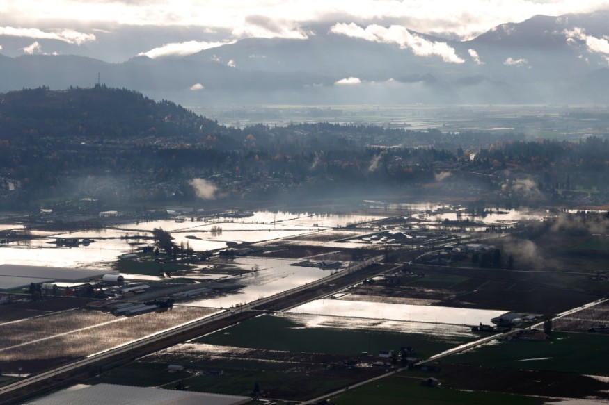
Over recent years, several incidents of overland flooding has gripped B.C. and other Canadian provinces, as floodwaters from overflowing rivers and melting ice enter houses and other establishments. .
While similar evacuation orders were issued in the past, there were instances where flash floods occur with little or without warning.
Scientists have been on high alert since May after an expert issued a warning that B.C. may brace for an increasing flood risk in the coming months at that time.
The latest developments prove that such warning may be viable since the expert predicted that the greatest risk will fall during the summer season, which approximately spans from June to September in Canada.
B.C. Flood Risk
Local officials on the evening of Sunday, June 5, ordered residents of the so-called Terrace-area communities of Old Remo, New Remo, and Usk to evacuate from their homes and register at a community center east of the Terrace, according to a report by The Canadian Press, as cited by Global News.
The Regional District of Kitimat-Stikine also issued a declaration of a local state of emergency as a flood watch remains in effect for Skeena River and Bulkley River, ranging from Telkwa and Smithers all the way to the communities in Terrace.
Additional flood watches were issued for Dean River in the Fraser Plateau, located east of the B.C. community of Bella Coola, and for the Liard River and its surrounding tributaries around Fort Nelson, as well as along Highway 97 into Watson Lake.
High Streamflow Advisories
CTV News Vancouver also cited the Canadian media release, indicating that high streamflow advisories have been posted for a multitude of other rivers and streams across northwestern corner of the Canadian province.
Meanwhile, the River Forecast Centre reportedly said rainfall and warm weather across northern B.C. will fill up waterways at least until Monday.
It added the flood danger is decreasing for most of the southern interior, which covers areas from the Cariboo Plateau to the United States border.
Increasing Flood Risk
On May 10, Jonathan Boyd, a B.C. hydrologist with the River Forecast Centre, issued a warning of the increasing flood risk across the province.
Boyd emphasized this is due to the persistence of cold temperatures which delays the snow melt across the region, as per Tri-City News.
Meteorologists and other hydrologists were alarmed following the flood warning.
As snow, ice, or frozen water piles up across B.C., the expected heat and other weather hazards brought by the summer season could eventually lead to rapid melting, Boyd explains.
In the coming weeks and months, a combination of heat waves, heavy rain, or severe thunderstorms may reportedly contribute to the flood threat across the province.
© 2026 NatureWorldNews.com All rights reserved. Do not reproduce without permission.


