A wildfire is wreaking havoc on the outskirts of a tourist town in northern Arizona since Tuesday, April 19, destroying dozens of structures and hundreds of homes. A
large-scale evacuation of both animals and residents took place.
The rapid spread of the flames caused a "wall of fire" the size of a ten-story building in the area .
The event is considered to be catastrophic in Arizona, proving previous climate reports that wildfires are increasing in frequency and intensity across the Continental US.
Wall of Flames
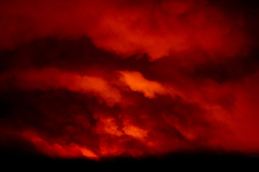
Blazes as high as 100 feet (30 meters) forced residents in 700 homes to flee from the raging flames on dry grass and Ponderosa pine trees outside Flagstaff in Coconino County, Arizona. More than 1,000 animals, including pets and livestock, were also evacuated, as per ABC News.
An estimated 250 structures are still under threat as of Wednesday, April 20.
Wind gusts of 80 kilometers per hour (50 miles per hour) also pushed the fires into a major highway in Arizona, with no clear of weakening as of the latest reports.
Coconino County officials declared a state of emergency after the wildfire expanded from 100 acres (40 acres) on Tuesday morning to more than 9 square miles (23 square kilometers) during the evening. The intensity and size of the wildfire caused a large amount of ash to fall from the sky.
The declaration of emergency means that the affected area will be subject to prioritized efforts such as emergency response, as well as relief and recovery measures. It also allows local authorities to impose strict measures and utilize urgent funds from the local or national government.
Growing Flames
The flames have continued until Wednesday around homes into volcanic cinder fields, wherein its roots underground are combustible, according to fire officials.
Dick Fleishman, a fire information officer, stated that the Arizona wildfire is a wake-up call for all people across the state, emphasizing that homeowners should clean up the grass next to their property to hamper the spread of flames, via the Associated Press.
The total land area burnt across the US by wildfires has increased by 30% in a ten-year average, as per AP News.
The US media outlet added that it increased from 20% when last month's wildfires ravaged the southern and southwestern states.
In addition, it mentioned that "above-average temperatures" and "below-average precipitation" combined with spring winds have significantly contributed to the risk of deadly wildfires.
Wildfire and Weather
Various research has suggested that climate change affects weather patterns and influences the occurrence and intensity of wildfires.
A recent paper indicated that wildfires in the US have become "more frequent" and "more widespread" since 2000, as per a study published in Science Advances in March, as cited by CBS News.
The research suggested that wildfires have transpired in areas that were once not frequented by fires, highlighting that such a pattern will continue in the long-term future.
Although wildfires are not considered a weather phenomenon, they are directly related to weather, according to the National Oceanic and Atmospheric Administration (NOAA) - National Weather Service (NWS).
In a term used by US meteorologists, 'fire weather' dictates the potential behavior of a wildfire since the latter's spread is based on climatic and weather-related factors such as precipitation, wind, and heat.
© 2026 NatureWorldNews.com All rights reserved. Do not reproduce without permission.


