A significant and widespread rain event is starting in the southwestern United States, according to AccuWeather analysts, and will continue early this week. While any rain will be welcome in the parched region, the severity of the downpour may cause some problems.
According to forecasts, it all started late Sunday for the West Coast.
Making Landfall
On Sunday, a growing storm made landfall on the California coast, dumping heavy rain on San Francisco in the evening and Santa Barbara and Los Angeles overnight. On Sunday night, showers began to fall further north in locations like Medford, Oregon.
At times, the rain will persist for much of Monday in California, with showers. Coastal California and the Sierra Nevada range areas will be hit most by this storm's steady rain. Snow is expected to fall in the Sierra Nevada's highest elevations, while rain is expected to fall mostly at lower levels.
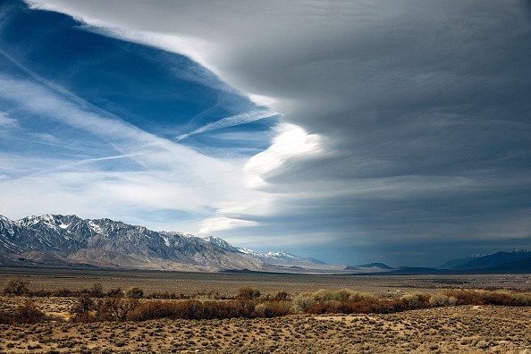
The rain will spread eastward on Monday, bringing showers to much of Nevada. Showery weather is expected to arrive in Las Vegas by Monday evening. Since January 18, there hasn't been any measurable precipitation, defined as 0.01 inch or greater.
Wet Weather
Wet weather will spread across a large expanse of the Southwest by Monday night, from California to at least Utah and Arizona.
Back on the coast, a surge of energy in the upper atmosphere Monday night may bring the possibility of a few thunderclaps and perhaps isolated cases of tiny hail for parts of Southern California. Anyone out and about in big cities Monday night, such as Los Angeles, should keep an eye on the sky for shifting weather conditions.
As the storm passes over the Rockies, the rain will taper down across California, Oregon, and Nevada by Tuesday.
The winter months are the wettest in California and much of the Southwest, so the dry spell since the beginning of the year could not have occurred at a worse time climatologically.
Less Than Average Precipitation
Many communities across California have hardly received a quarter of the average precipitation during the wet season since 2022. In less than 48 hours, the rainfall received this year might be more than quadruple in some regions.
Since January 1, Downtown Los Angeles has received only 0.34 of an inch of rain, a miserable 4 percent of its typical rainfall. Not to be outdone, adjacent Santa Barbara received only one-tenth of an inch of rain over the same time period, a staggering 1% of its typical rainfall.
The Bay Area, further north, is likewise unusually dry. San Francisco has received only 8% of its average precipitation this year, while Oakland has received only 7%.
Rainfall quantities of 0.50 to 1 inch are expected over the country during this early-week storm, with some places receiving 1-2 inches.
According to Senior Meteorologist Dave Houk, favored upslope locations might see as much as 2-4 inches of rain. Parts of the Transverse Ranges and the Sierra Nevada are included.
While this quantity of rain is unlikely to alleviate drought conditions in the Southwest, any amount of rain will be welcome in the dry region. According to the US Drought Monitor, more than 90% of California is experiencing severe drought, while 100% of Nevada is experiencing the same. Drought Monitor is a website dedicated to tracking drought conditions.
"While the rain is welcomed and helpful," Meteorologist Ryan Adamson said, "downpours can increase the risk of floods and debris flows in regions recently burnt by wildfires."
Furthermore, rainfall may cause transport interruptions in densely populated locations like Los Angeles, where rain is rare.
Along with precipitation, next week's storm will help to reduce the unseasonably warm and, at times, record-breaking temperatures of the previous week. Temperatures started to drop on Sunday, but they'll settle on Monday.
Cooler Temperatures
Many places will be 20-25 degrees Fahrenheit cooler by Monday than they were on the warmest day of the week. These colder temperatures will persist for the rest of the week before rising to more seasonally appropriate levels by the beginning of April.
Related Article : How Climate Misinformation Through Social Media Worsens the Battle Against Climate Change
For more news about similar news, don't forget to follow Nature World News!
© 2026 NatureWorldNews.com All rights reserved. Do not reproduce without permission.


