Strong storms raged through North Texas Monday evening, clogging the rush-hour travel for thousands of cars and leaving plenty of hail in their wake.
The National Weather Service will look into at least one tornado that occurred during Monday's storms in Fannin County.
It is said to have landed around Leonard and Trenton, close south of Bonham.
There have been allegations of structural damage in the region near Highway 78. The NWS will most likely be out there Tuesday to assess the damage.
A wild start to storm season
According to abc News, the early spring storm season in North Texas began last Monday night with a burst of activity that brought hail, funnel clouds and a verified tornado to the region.
The National Weather Service reported a tornado that occurred Monday night in Fannin County on Tuesday morning, while officials were still assessing damage to establish the tornado's rating.
Aerial film taken Tuesday morning revealed extensive damage to a number of buildings, including sheds and barns, as well as some roof damage to residences.
The damage occurred in Leonard, approximately an hour northeast of Dallas, while storm warnings were issued for the majority of Dallas-Fort Worth late Monday afternoon and into the evening.
While most of the area had only a few thunderstorms and short downpours, locations directly to the northeast of Dallas experienced far more severe weather.
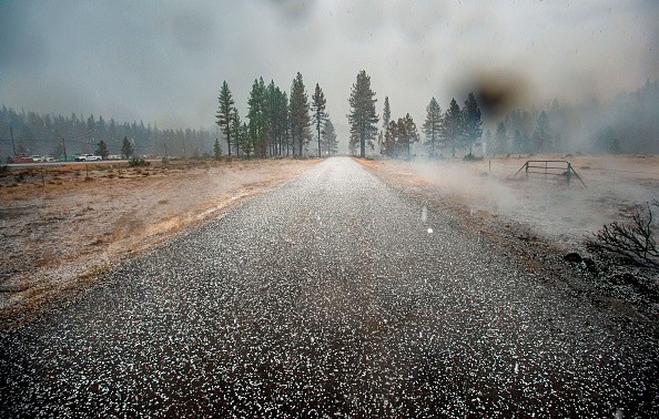
The remainder of North Texas was hit with severe rain and hail. When it was done, parts of Rockwall had so much hail that it appeared like snow on the ground. As per Fox 4 news.
The hail was mostly tiny and brief, while some locations were hit harder than others.
People residing east of Interstate 35 E saw torrential rain, lightning, and hail as a result of the fast-moving thunderstorms.
People in Dallas observed penny to quarter-sized hail near SMU's campus. Drivers on their way home from work on Monday evening were pummeled with tiny hailstones.
Read more : New Weather System to Bring Thunderstorms, Tornadoes, and Hail in the Western US and Central US
NWS warned people for further forecast
The majority of the thunderstorms will head east after midnight, according to the meteorological service, with a few showers possible in the northeastern counties. According to the weather service, certain storms may produce tiny hail.
Storms should clear away by late Monday, around 11 p.m., according to KXAS-TV (NBC5) meteorologist Brian James, leaving temps in the 40s overnight.
Temperatures will rise to the upper 70s and low 80s by Wednesday, with another chance of rain on Thursday, according to James.
They'll need to be weather-savvy, he added. In D-FW, they'll keep an eye out for where the storms develop, but it'll most likely be to the east.
Weather forecast for the week
Monday: Partly overcast, windy, and warmer in the morning, then partly cloudy, windy, and hotter in the afternoon. By nightfall, there is a 20% chance of thunderstorms, primarily east of Dallas.
Tuesday will be sunny and somewhat chilly. Wednesday will be mostly sunny and mild.
Thursday: Partly overcast, warm, and windy. There is a 30% probability of late-day thunderstorms.
It will be partly overcast and colder on Friday.
Related article : Thunderstorms in Ontario Caused Intense Hail Storm, Damaging Crops
© 2026 NatureWorldNews.com All rights reserved. Do not reproduce without permission.


