AccuWeather Meteorologists are closely monitoring a new blast of Arctic air and a possible winter storm along the East Coast, which is expected to hit some regions on Valentine's Day.

Forecasters Monitors Snowstorm Potential
This weekend, temperatures are expected to reach highs of 50 degrees F along the Atlantic Seaboard, getting to 30s and 40s across Appalachia, which is 10 to 20 degrees above normal for this time of year, according to AccuWeather.
While recent Arctic blasts have seen temperatures plummet to minus 30 degrees Fahrenheit, the sudden change in temperatures could add to their shock effect. There is also a possibility that a storm will form, grow in strength and then try a northward shift across the western Atlantic from this weekend to Valentine's Day.
According to AccuWeather's Chief On-Air Meteorologist Bernie Rayno, the antennas are still up for an East Coast storm on Sunday and Monday.
Rayno also noted that it's unclear how far north wintry precipitation, including snow, will spread. Snowfall locations will be determined by the storm's exact path, which AccuWeather forecasters are still debating.
It is expected that Arctic air will move from the northern Midwest and Plains on Friday to the western Gulf of Mexico on Sunday morning because of a dip in the northern jet stream.
Due to a storm close, Sunday's onward movement of cold air is expected to decelerate and maybe stall around the southern Atlantic coast.
AccuWeather Lead Long-Range Meteorologist Paul Pastelok explained that with enough separation in the two features, there is potential for the southern feature to intensify and allow a storm to travel farther north than would occur in a typical progressive pattern.
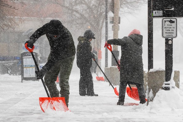
This week's procession of Albert clippers bringing snow over the northern United States demonstrated how storms and air masses tend to move in a progressive manner. Sunday and Monday could see some accumulations of snow or a wintry mix move up the Interstate 95 corridor in the mid-Atlantic and New England regions.
Areas Expected to See Snow
Even if the storm misses the East Coast, snow or a wintry mix may be experienced in the Carolinas and southeast Virginia on Sunday and into early Monday, according to the latest forecasts, as per MSN.
As much as 180-250 percent of the average seasonal snowfall has fallen in cities like Charlotte, North Carolina; Greenville, South Carolina; and Norfolk, Virginia, so far this winter.
According to Pastelok, the pattern has the look that a banana-shaped area of high pressure may form with the cold air from northern New England to the western Gulf Coast, which would be an ideal setup for wintry precipitation in the East even if only a small area was affected.
Arrival of Arctic air
No matter how the storm behaves, the Arctic air is expected to arrive, serving as another reminder that winter hasn't ended yet.
In fact, the season's midway point was just last week. In the northern Midwest and New England, highs in mid-February typically range from the low to mid-20s to the upper 50s in Atlanta and the mid-60s in Houston.
Despite the reality check, the air mass will not be as frigid as those that have previously visited so far this winter, and it is only likely to last a day or two rather than several days or weeks on end, AccuWeather Senior Meteorologist Brett Anderson stated.
Temperatures in Texas and the southern Plains may have received their final substantial dose of Arctic air of the winter season, according to Pastelok.
Cold air from the Midwest will continue to blow northeastward, although there will be ups and downs in temperatures rather than a long stretch of freezing temperatures.
Temperatures in the eastern two-thirds of the United States are expected to warm up significantly in March, according to AccuWeather's long-range forecasters.
Significant winter storms are still a possibility because pockets of cold air can still meet storms and produce snow.
Related Article : Multiple Alberta Clippers May Bring Snow to Midwest, Northeast
For more news, updates about snowstorm and similar topics don't forget to follow Nature World News!
© 2026 NatureWorldNews.com All rights reserved. Do not reproduce without permission.


