AccuWeather meteorologists are tracking the next clipper expected to arrive on Tuesday night and may last through Thursday as it heads toward the east. The storm is expected to bring snow to more than a dozen states in the Midwest and Northeast.
Snow storms are may hit the upper Midwest, Great Lakes, and the interior Northeast this week and are expected to bring heavy snowfall.

Areas Expected to See Snow
An Albert Clipper is a fast-moving low-pressure weather system that arises east of the Rocky Mountains in western Canada during winter months and moves east-southeast over central Canada and into the northern United States.
It is common for the system to bring extreme cold and strong winds of up to 45 miles per hour, with temperatures dropping by as much as 30 degrees Fahrenheit in just a few hours. However, the Alberta Clippers don't usually bring a lot of snow.
However, "lake effect" snowfall of a foot or more can occur when a storm is picking up moisture over the Great Lakes, and these storms often generate just a few inches of snow.
According to AccuWeather, 1-3 inches of snow is expected to fall from northern Ohio to western New York, with places east of the Great Lakes expected to receive significantly more snow. Parts of northwest Michigan will see heavier accumulations of snow because of the lake effects.
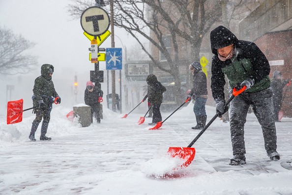
The Storm May Cause Travel Disruption
In the wake of last week's massive winter storm, AccuWeather Meteorologist La Troy Thornton says that these quick, lighter episodes can be seen as a relief of sorts, referring to the storm that covered an area of more than 2,000 miles.
Even while these storms aren't forecast to dump a lot of snow, they might nevertheless cause serious problems for travelers in the area, as per UPI.
Predictors have warned drivers to provide extra time for travel, as well as to pack an emergency kit in case of vehicle breakdowns or delays in the traffic.
According to Thornton, these clipper systems are likely to remain well north of the areas that suffered heavy icing.
This clipper is unlikely to provide any rain to the big cities along Interstate 95. According to Thornton, the season has been a rather active winter and a respite from the regular major storms may help to soothe the 'winter weariness' that some residents may be feeling.
Upper Midwest, Northeast to Experience Chilly Weather
One more polar vortex is anticipated to hit over the weekend, so the region isn't completely safe from winter weather yet. As Thornton put it, the storm track seems to favor these fast-moving, less powerful systems.
Storms are likely to bring temperatures in the Great Lakes, Ohio Valley and interior Northeast 3 to 7 degrees below average, despite the fact that many densely populated areas will not see snowfall.
A new wave of cold air will be pushed into the upper Midwest and northeast this week by a succession of rapidly moving Alberta clippers, according to AccuWeather Senior Meteorologist Michael LeSeney. Many places will remain quite chilly this week, he said.
AccuWeather RealFeel® Temperatures will also plummet, making it feel even colder as the mercury drops to shivering levels.
Related Article : Upper Midwest, Great Lakes May Receive Fresh Snow From Alberta Clipper
For more news, updates about storms and similar topics don't forget to follow Nature World News!
© 2026 NatureWorldNews.com All rights reserved. Do not reproduce without permission.


