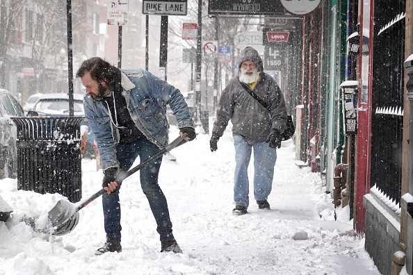
Snow and treacherous ice from a cross-country storm may cause hazardous travel conditions in the interior Northeast on Thursday and Friday, as per AccuWeather meteorologists.
Even after the storm leaves the area at the end of the week, Boston and portions of the New York City and Philadelphia metro areas may experience slick travel conditions.
Wintry Precipitation Expected in Northeast
According to AccuWeather, storms can persist up to 48 hours in parts of the Central and Interior Northeast, according to AccuWeather Senior On-Air Meteorologist Justin Povick, who said the "storm is a marathon and not a sprint."
Temperatures are likely to rise into the 40s F along much of the Interstate 95 corridor in the Northeast on Thursday as the warming trend that began on Tuesday continues. Inland to the mountains, temperatures will rise above freezing.
As a result, Thursday's rain will spread from the mountains to the upper mid-Atlantic and New England coasts because of moderate air. The mix of melting snow, rain, and blocked storm drains can lead to street and highway flooding in regions with significant heaps of snow left over from the previous snowfall.
Ice can form on untreated and shady surfaces where the ground remains cold, especially if they are untreated and not in direct sunlight.
Because the rainfall and snowmelt levels are not likely to be strong or fast enough, widespread flooding of streams and rivers isn't projected.
Parts of the central Appalachians and central and southeastern New England will see some ice break up due to the warming weather. Ice can become wedged up when water levels suddenly rise.
There is a chance that ice-jam flooding will be isolated. The danger will be minimized as well by a swift return of cold air to the area.
Areas to Experience Snow
From Thursday to Friday, when the first of two storms in the double-barreled system moves out from the region and another storm comes, rain will turn to snow and ice across the central Appalachians and most of New England, as colder air presses in from the northwest to southeast.
A wintry mix that formed Wednesday night in northern New England and northern and western New York state will turn to snow by Thursday.
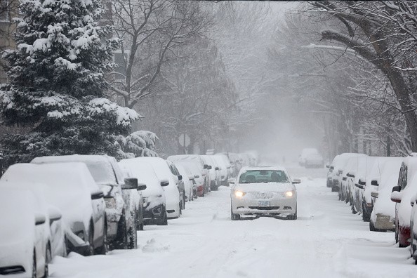
Since the beginning of the week, the area that is expected to receive the most snowfall has been moving southeast due to a shift in the predicted path of the second storm. From the southern coasts of Lakes Erie and Ontario to central and Down East Maine, a 12- to 18-inch snowfall zone is expected.
Several cities, including Cleveland, Erie, Buffalo, Syracuse, Montpelier, Vermont, and Augusta, Maine, have a good chance of getting a foot or more of snow from the long-term storm, according to WVNews.
It is most likely that the Adirondack, Green, and White Mountains in the region will see an AccuWeather Local StormMaxTM of 30 inches, according to AccuWeather Meteorologist Brandon Buckingham.
The Storm May Create Hazardous Travel Conditions
Most road personnel are well-equipped and prepared to deal with the significant snowfall in that area. In contrast, ice is a different story, and there is a region in the Northeast that is at risk of a major storm in that regard.
The storm's most hazardous travel conditions are expected to be in the Hudson Valley of New York and Massachusetts, as well as eastern and southeastern Ohio, Pennsylvania, and much of New Jersey.
Pittsburgh, Wilkes-Barre/Scranton, Poughkeepsie, New York, and Worcester, Massachusetts are all in the danger zone for ice buildup. Power outages are common in this region of the Northeast, so residents there should be prepared for them.
Parts of this area may be spared the worst of the ice and snow if they get more sleet than freezing rain, or if the ice and snow quickly turn back to rain.
The lower Hudson Valley of New York, northern West Virginia, southeastern Pennsylvania, and southern New England are all expected to see some ice and snow buildup by Friday, resulting in some slick driving conditions.
Regardless of how much snow falls or how long a wintry mix of precipitation lasts, temperatures will drop significantly in the last stages of the storm.
As the storm continues, temperatures are expected to fall into the 30s and 20s F near Pittsburgh on Thursday night. On Friday, temperatures in Pittsburgh may not climb at all but may drop to the single digits at night.
For more news, updates about storms and similar topics don't forget to follow Nature World News!
© 2026 NatureWorldNews.com All rights reserved. Do not reproduce without permission.


