Metro areas in Northeast US are already under winter storm watches as forecasters predict heavy snow and strong winds in the region, although it is not yet clear how bad it will be.
Several states including eastern Massachusetts and Rhode Island will see 12 to 24 inches of snow starting late Friday through Saturday, associated with wind gusts up to 60 mph.
Boston, capital and most populous city in Massachusetts, is already warned a snowfall rate of 3 to 4 inches per hour according to Boston National Weather Service.
As of Thursday afternoon, more than 42 million people in Philadelphia, New York and Boston, among others, were under winter storm watches as extreme and heavy snowfall totals is predicted.
"With this forecast package, we have capped the totals at 24 inches. But if we get more confidence, the forecast amounts for southeastern MA could go up into the 30 to 36 inches range," the weather service reports in CNN.
Winter hurricane to occur in the region
A bomb cyclone in the process known as "bombogenesis" is expected to form Friday in the Atlantic Ocean just off the coast of Georgia, then rapidly strengthen overnight Friday and track Saturday up the East Coast, the report adds. In the meantime, specifics on the impact are not known.
CNN meteorologist Brandon Miller said the "storm is likely to strengthen at a rate, and to an intensity, equivalent to only the most powerful hurricanes," which is why the high-end potential of this storm remains unclear. "But with nor'easters, like in real estate, it will all come down to location, location, location."
Heavy snow and strong winds are likely across New England, "which could lead to blowing snow, scattered power outages, and some damage," NWS Weather Prediction Center said early Thursday.
Moderate to heavy snow is possible from northeast North Carolina to New York, "but confidence in potential impacts is much lower," the forecasters added.
CNN Weather adds that the bomb cyclone will unleash blizzard-like conditions throughout the Northeast "joined by winds gusting over 35 mph for more than three hours and creates visibility of less than a quarter of a mile."
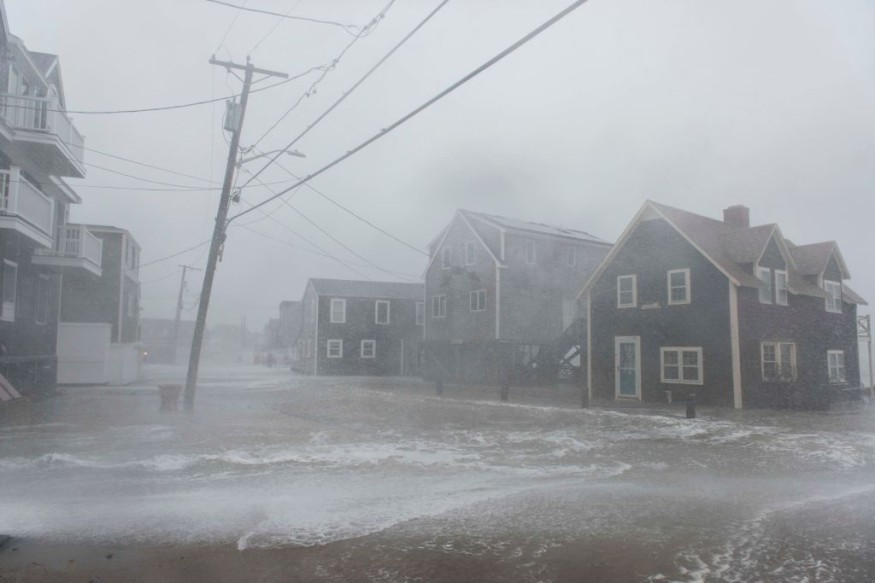
Possible coastal flooding
While it is "too early" to predict the precise impact of the storm and snowfall totals, a wintry mix will be possible for some eastern coastal sections.
"We can't rule out a shift back to the west or even a further eastward shift with less snow," forecasters said early Thursday. Besides gusting wind and blowing snow, coastal flooding and beach erosion are a possibility for some places. A stronger storm would mean greater surge of water along the coast.
According to the weather service, the combination of strong northeast winds and high seas could lead to minor or moderate coastal flooding.
Meanwhile, a blast of Arctic air is expected to bring scattered snow showers across the Great Lakes region.
© 2026 NatureWorldNews.com All rights reserved. Do not reproduce without permission.


