AccuWeather RealFeel Temperatures will plummet well below zero this week as a result of multiple blasts of very cold air moving across the Midwest and Eastern Seaboard.
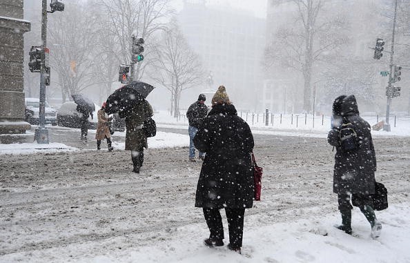
Following this past weekend's massive snowstorm, the Midwest and a greater portion of the East are expecting a brutally cold blast of Arctic air this week. Experts predict it's going to be the longest run of chilly air so far this season.
Areas to Receive Cold, Frigid Air
Storms in the eastern United States were hit by the same "Saskatchewan Screamer" that dumped over a foot of snow in Des Moines, Iowa on Friday into Saturday. However, two consecutive blasts of cold air will sustain the wintry frost as the storm dissipates.
A break in the jet stream pattern will allow chilly, icy air to pour into the Midwest, Southeast, and Northeast early in the week.
This week and into late January, AccuWeather meteorologists are monitoring a more forceful blast of Arctic air that will be permitted to drift south from Canada into the north-central United States.
On Monday, a blast of chilly air will blow over the mid-Atlantic region, bringing highs in the 30s and 40s to the Tennessee and Mississippi valleys. On Monday, highs in the Upper Midwest will barely rise above the mid-twenties in areas further north and west, according to Accuweather.
Also Read : Snowmageddon 2022: Multiple Winter Weather Alerts Raised All Over US Due to Arctic Blast
Clipper Storm Expected to Drop Across the Midwest
Cold weather pattern had an unintended consequence. Disturbances continue active over the northern Pacific, and these will move onshore over western Canada. This type of storm is known as an Alberta clipper because it originates from Alberta in Canada and moves quickly through the Great Lakes and Northeastern United States.
As of Tuesday, AccuWeather meteorologists have been tracking a clipper storm that will drop across the Midwest and move into the Northeast by Wednesday evening. This storm could bring snow to parts of Minnesota, Michigan, Wisconsin, and the Northeast.
On Tuesday, a clipper-like storm will sweep across the Canadian Prairies, dumping 3 to 6 inches (8 to 15 cm) of rain on some areas as far north as Minnesota.
From Thunder Bay to just north of Ottawa, Ontario where the AccuWeather Local StormMaxTM of 15 inches (38 cm) could fall, the fast-moving storm will travel over the upper Great Lakes and into northern New England late Tuesday into Wednesday evening.

Gusty Conditions Across Parts of the Midwest
On Wednesday, bitter cold and high pressure will bring low temperatures to the north-central United States, where International Falls, Minnesota, and Minneapolis, Minnesota, will only achieve a high of -4 and 5 degrees, respectively.
AccuWeather RealFeel® Temperatures may fall far below zero at times over northern Illinois, Iowa, and Minnesota, as well as northward to the Canadian border, due to gusty conditions across parts of the Midwest.
AccuWeather RealFeel® Temperatures are expected to plunge to -15 degrees in Minneapolis and -32 degrees in Fargo, North Dakota, on Wednesday morning and afternoon.
Temperatures are expected to drop from Tuesday afternoon to Wednesday afternoon in the centre of the country as Arctic air descends from the north.
Even Dallas, which is in the southern part of Texas, could witness a 10- to 20-degree dip in temperature over the course of a day. Residents of Iowa, eastern South Dakota, and Minnesota, which are further north, may expect a 30- to 40-degree drop in temperature in the next day or two.
For more news, updates about low temperatures and similar topics don't forget to follow Nature World News!
© 2026 NatureWorldNews.com All rights reserved. Do not reproduce without permission.


