Meteorologists were busy monitoring the possibility for yet another winter storm to take shape and target areas from the Midwest to the Northeast late this week, while sections of the mid-Atlantic were coping with the first substantial blizzard of the season early this week.
The second storm, which is now developing, can bring snow from the Ohio Valley into the Northeast that was missed by the early-week storm, and more snow might reach sections of the Interstate 95 corridor.
Chief On-Air Meteorologist Bernie Rayno said: "I'm certain there will be a storm Thursday into Friday," but that its specific route is still unknown at this time.
He predicts that snow will fall from the Midwest into the Northeast Thursday night into Friday. The storm will most likely travel up the East Coast, he warned.
A storm path that far to the west would bring snow to locations west of the I-95 corridor, with wintry weather in the interior mid-Atlantic and New England. A stronger storm system would result from this scenario.
Weather All Over the US
On the southerly, "the odds are against snow for New York City to Washington, D.C.," Rayno stated.
The opposite extreme, taking a smaller storm straight East and out to sea from the mid-Atlantic, was still considered by analysts. In that scenario, some snow might fall over the mid-Atlantic, including in the nation's capital. According to Rayno, if that estimate holds, Philadelphia, Baltimore, and Washington, D.C. may all see snow.
Winter Storms

The following winter storm will be triggered by a fresh influx of cold air behind a cold front that will stall from the Midwest to the mid-Atlantic and jet stream activity.
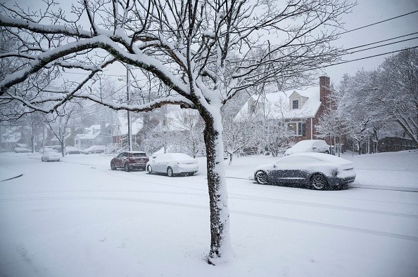
In the aftermath of a cross-continent storm that pulled the jet stream and accompanying cooler air deeper to the south this past weekend, the atmosphere began to shift gears toward a more normal winter weather pattern across the central United States.
On Monday, people in the East were feeling the effects of the changeover, with temperatures dropping 20-40 degrees from the previous weekend and heavy snow falling from western North Carolina and Virginia to Maryland, Delaware, and southern New Jersey.
Trajectory
On Monday, the storm managed to escape much of the Ohio Valley, middle Appalachians, and New England, despite heavy snow causing major transport disruptions and power outages near the mid-Atlantic coast.
About the forthcoming late-week storm, Rayno stated, "West of Interstate 95, be ready, as there is snow on the way." As details emerge, "all of the components for a storm, including a fresh infusion of cold air, are there."
Meteorologists will keenly monitor the coming storm and its swath of snowy weather.
For more news about making the environment sustainable, don't forget to follow
© 2026 NatureWorldNews.com All rights reserved. Do not reproduce without permission.


