A 7.8-magnitude earthquake struck the Alaskan Peninsula on Tuesday at 10:12 p.m. local time, prompting a tsunami warning for areas within 200 miles of the epicenter. The tsunami alert and advisories were later canceled. As of this writing, there are no reports of injuries nor damage yet.
The powerful quake occurred at approximately 500 miles southwest of Anchorage, and 60 miles south-southeast of Perryville.
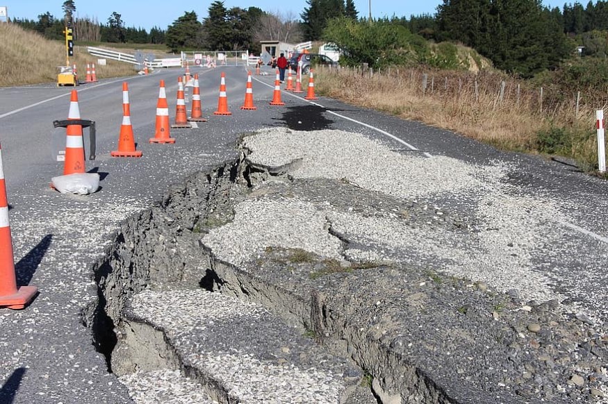
The earthquake was about six miles deep, a shallow quake, the US Geological Survey said. According to CNN Meteorologist, anything below 43 miles in depth like this earthquake is considered shallow, which causes the most damage compared to deeper quakes and regardless of strength.
Earlier, the Pacific Tsunami Warning Center warned that "hazardous tsunami waves are possible for coastal areas located within 300 kilometers of the earthquake epicenter."
South Alaska, Alaska Peninsula, and the Aleutian Islands were also issued with a tsunami warning alert.
The warning for South Alaska and the Alaska Peninsula is from Kennedy Entrance to Unimak Pass to Samalga Pass.
As of Wednesday early morning, however, all tsunami warnings and advisories were canceled, the National Weather Service said.
Since the earthquake, at least 11 aftershocks were recorded with magnitudes ranging from 3.9 to 6.1.
Affected resident, Homer described that the bed and curtains were moving, and he thinks it was a very long quake.
The local high school and a local Catholic school were opened as the evacuation center in Kodiak island. Larry LeDoux, the superintendent of the Kodiak School District, said they have a high school full of people, and he had been passing out masks since the alarm sounded.
"Everything's as calm as can be. We've got probably 300, 400 people all wearing masks," he said.
How often do earthquakes in Alaksa occur?
Alaska, which lies in the active Pacific Ring of Fire, is so used to earthquakes. After all, the Pacific and North American plates are constantly moving for the position above the mantle. It holds 11 percent of the world's earthquakes. Of the six major earthquakes recorded in history, three happened in Alaska.
Earthquake is so common in Alaska that since 1900, there have been six other earthquakes of magnitude 7 and higher, 45 earthquakes of magnitude 6 or 7, and get a total of 10,000 quakes every year.
The most infamous earthquake was the 1964 Great Alaska Earthquake. It had 9.2-magnitude and lasted for more than4.5 minutes. It was the strongest ever to hit North America. Anchorage was devastated, and a tsunami hit the Gulf of Alaska, the U.S. west coast, and Hawaii, and the disaster claimed the lives of 250 people. The epicenter was the Prince William Sound, while the tsunami consumed Anchorage turning it into a disaster area.
The tsunami was so powerful that smaller communities along Prince William Sound like Valdez were moved into a new location, six miles from the original site.
A magnitude 7.1 earthquake struck Cook Inlet on January 24, 2016, which was approximately 100 miles south of Anchorage. Anchorage had minor damage, but gas and water lines on the Kenai Peninsula were damaged.
© 2026 NatureWorldNews.com All rights reserved. Do not reproduce without permission.


